News Summary
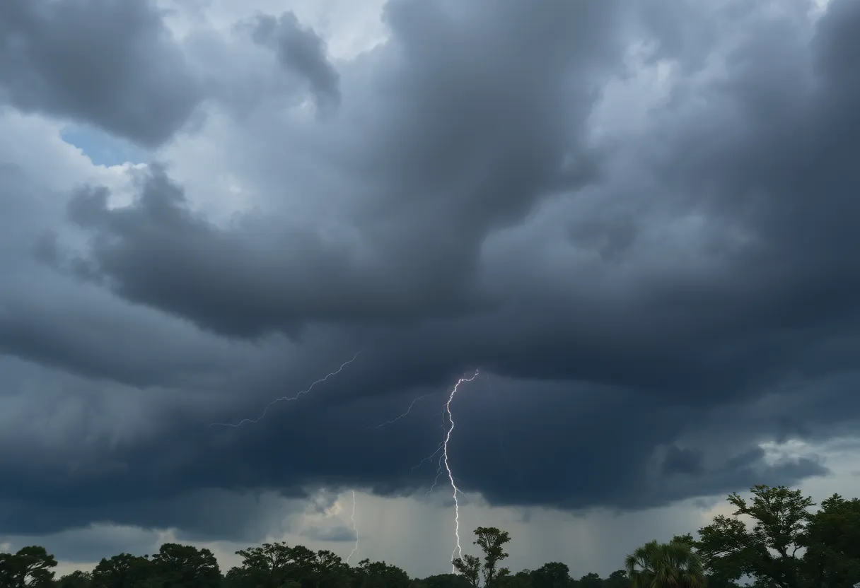
Columbia, South Carolina, faces a severe weather warning as the National Weather Service predicts thunderstorms and tornado risks. Strong winds reaching 50 mph and the possibility of hail pose significant hazards. With ongoing storm activity expected throughout the weekend and even more severe weather looming early Tuesday, residents are urged to take precautions. Flood risks are heightened, leading to suspended recycling services and localized damage. Officials recommend seeking shelter in low-level interiors during severe storms and staying informed on weather updates.
Severe Thunderstorms and Tornado Risks Prompt Weather Alerts Across Columbia, South Carolina
Residents of Columbia, South Carolina, are on high alert as the National Weather Service issued a severe weather statement early Saturday afternoon. The stormy situation started to unfold around 2:04 p.m. when a strong thunderstorm was picked up by Doppler radar near Red Bank. With forecasts indicating that central Lexington and northwestern Richland counties would be in the storm’s path until around 2:30 p.m., everyone is advised to take precautions.
What to Expect
Buckle up, because wind gusts from these storms could reach a hefty 50 mph. There’s also potential for half-inch hail, which could create quite the spectacle but also pose a risk to your property. Those strong winds might even knock down tree limbs or send unsecured items flying around, so it’s definitely a good idea to secure anything that could become a projectile.
The storm activity is expected to continue with scattered storms starting early Saturday afternoon and lasting into the overnight hours, possibly extending into early Sunday morning. But folks in Columbia should keep their guard up even after that, as there’s a slight threat of severe weather primed to hit from 3 a.m. to 7 a.m. on Tuesday. With multiple rounds of severe storms rolling in from the northern Midwest states, the potential for disruption remains.
Flooding and Tornado Concerns
If that’s not enough to worry about, tropical cyclone conditions have caused heightened flood risk in multiple areas, including Boone County. Just this past Sunday night, three individuals found themselves needing rescue from a car trapped in floodwaters in Boone County. It was also reported that one person suffered a minor injury related to a possible tornado sighting in New Bloomfield—reminding everyone of just how unpredictable and dangerous severe weather can be.
As the storm rolled through, Columbia’s recycling services were abruptly suspended indefinitely. This is due to storm damage done to the Material Recovery Facility. On top of that, multiple outbuildings were destroyed at the Columbia Sanitary Landfill, causing significant melees along the way that included downed power lines, blocked roadways, and other hazards brought on by high water.
Stay Safe Out There
Currently, a flood watch is in effect for several counties in the area, including Boone and Callaway. Tornado warnings are also out for Boone and Moniteau Counties until 5:45 p.m. on Sunday. The region sits under a marginal risk for excessive rainfall, which could lead to flash flooding—a situation no one wants to find themselves in. Forecasts indicate winds might reach 10-15 mph, with isolated gusts possibly hitting 26 mph. Those in Columbia should expect heavy rain on Monday, a 100% chance of precipitation, with potential rain totals reaching up to 2 inches.
While temperatures may peak in the mid-70s on Monday, brace yourself for a drop in temp as cooler air moves in. Tornado watches are also extended until 11 p.m. in certain counties, prompting officials to recommend seeking shelter in low-level interiors during severe storms.
Final Thoughts
As the weather takes a turn for the worse, local officials are strongly urging residents to stay tuned to any weather alerts and prepare for possible hazards. If ever there was a time to ensure your emergency kit is stocked and your family has a safety plan, it’s now! Let’s all stay safe out there, Columbia!
Deeper Dive: News & Info About This Topic
HERE Resources
Severe Thunderstorm Alert for Lexington and Richland Counties
Governor McMaster Implements Centralized Weather Closure Policy
Severe Weather and Flooding Continues to Threaten Kentucky
Columbia, S.C. Weekend Events Showcase Music, Arts, and Community Festivals
University Students Discover Columbia’s Walk-Up Eateries
Changes Ahead for State Office Closures in South Carolina
Columbia Residents Prepare for Weather Regulations
Severe Storms Cause Widespread Damage in Minnesota
May 2025 Concert Lineup Announced for Columbia, SC
Fire Breaks Out at Morales Muffler Shop in Lexington, SC
Additional Resources
- Columbia Missourian
- KOMU
- The State
- Google Search: Severe Weather Columbia South Carolina
- Encyclopedia Britannica: Severe Thunderstorms
Author: STAFF HERE LEXINGTON WRITER
The LEXINGTON STAFF WRITER represents the experienced team at HERELexington.com, your go-to source for actionable local news and information in Lexington, Fayette County, and beyond. Specializing in "news you can use," we cover essential topics like product reviews for personal and business needs, local business directories, politics, real estate trends, neighborhood insights, and state news affecting the area—with deep expertise drawn from years of dedicated reporting and strong community input, including local press releases and business updates. We deliver top reporting on high-value events such as Woodland Art Fair, Crave Food and Music Festival, and Railbird Festival. Our coverage extends to key organizations like Commerce Lexington and Blue Grass Community Foundation, plus leading businesses in education, manufacturing, and technology that power the local economy such as University of Kentucky, Toyota Motor Manufacturing, and Lexmark. As part of the broader HERE network, including HEREBowlingGreen.com and HERELouisville.com, we provide comprehensive, credible insights into Kentucky's dynamic landscape.
