News Summary
A strong thunderstorm alert has been issued for Columbia, South Carolina, and surrounding counties. The storms are expected to bring severe winds, potential hail, and heavy rain, creating hazards like fallen tree limbs and flash flooding. Residents are advised to seek shelter and avoid travel during the storm. The National Weather Service has warned of rapid storm movement with gusts reaching up to 50 mph. Stay safe and informed as conditions change.
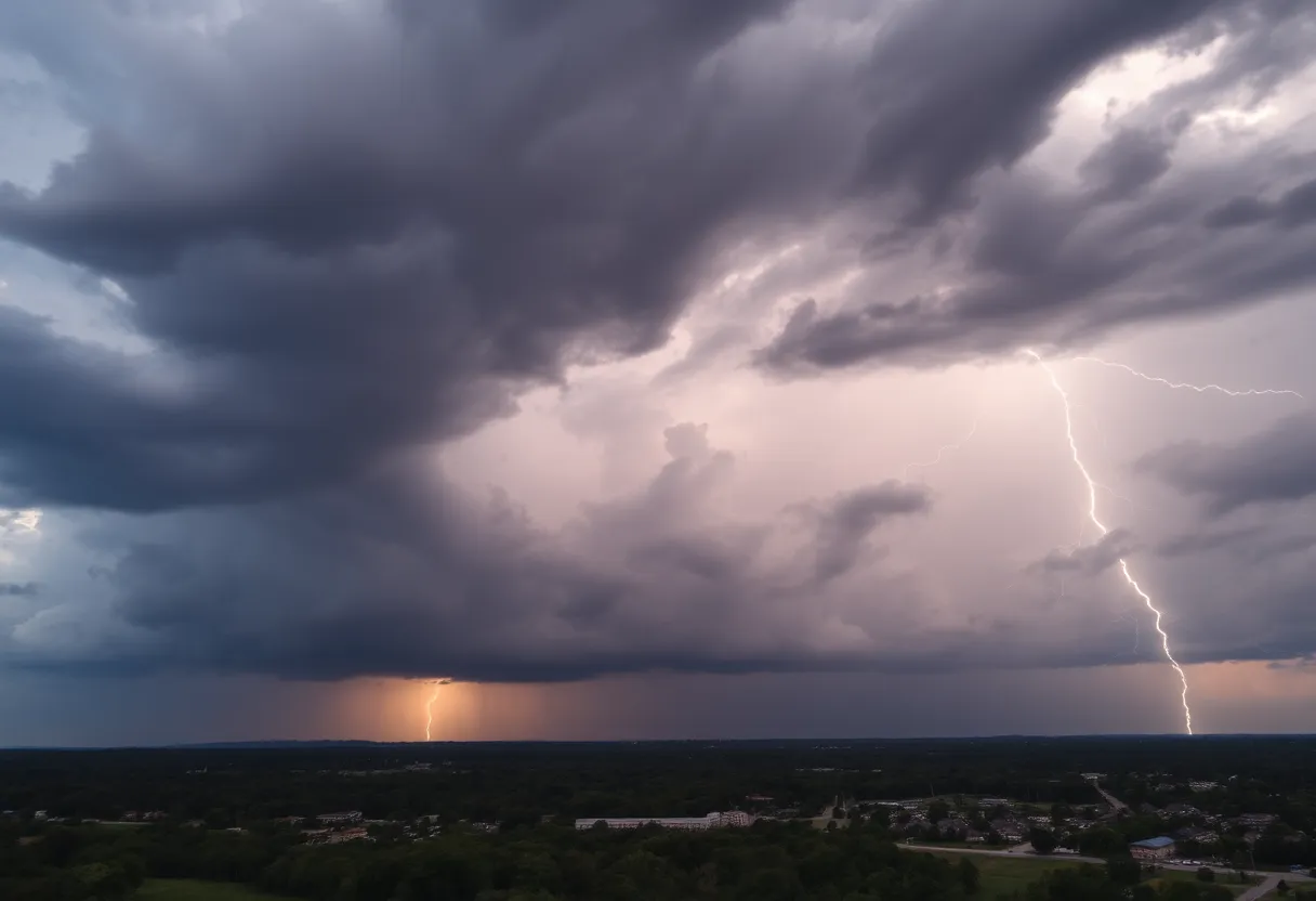
Strong Thunderstorm Alert in Columbia and Surrounding Areas
Hey there, folks! If you’re in or around Columbia, South Carolina, brace yourselves! A strong thunderstorm alert has been issued, and it’s something you definitely want to pay attention to. The National Weather Service in Columbia rolled out the alert at 1:30 a.m. on Sunday, and it’s set to stay in effect until around 2:15 a.m.
Who is Affected?
This alert isn’t just a Columbia thing; it’s affecting several counties including Southern Lancaster, Chesterfield, Kershaw, Lexington, Richland, Lee, Sumter, and even Calhoun. If you’re nearby, it’s time to stay alert!
What to Expect?
The radar shows some pretty fierce thunderstorms rolling in, with a strong line moving from near Pageland up to near Horrel Hill, and guess what? They’re zooming northeast at a brisk pace of 65 mph! This means you could be seeing wind gusts potentially hitting around 50 mph—yikes! Not to mention that pea-sized hail is also on the menu, so don’t get caught off guard.
Possible Hazards
With these gusty winds, be prepared for possibly knocked-down tree limbs and anything loose outside could be blown around. We’re talking minor damage to outdoor items, so if you have any patio furniture or garden decor, you might want to secure those to avoid a wind-blown disaster.
Impact Areas
Wondering where these storms might hit the hardest? Here are some key locations that will probably feel the brunt of it: Columbia, Sumter, Camden, Cheraw, Bishopville, Shaw Air Base, McEntire Air Base, and several more. Plus, if you’re traveling, be cautious on major highways like Interstate 20, 26, and 77—they’re all part of the storm region.
Safety Comes First
Now, safety is a top priority! If you’re outdoors, it’s strongly advised that you find shelter inside a sturdy building. And if you’re thinking about driving during this storm, be careful. It’s important to avoid areas with heavy rainfall because flash flooding is a definite concern. If you find yourself approaching a flooded roadway, turn around; it’s just not worth the risk.
Know What to Do During a Thunderstorm
During any thunderstorm, especially one with strong winds, here are some quick safety tips to remember:
- Stay Indoors! If you can avoid being outside, do it.
- Avoid Electrical Appliances: Water and electricity don’t mix!
- Watch Out for Hydroplaning: Be careful of wet roads; it’s easy to lose control of your vehicle when there’s water build-up in front of your tires.
The Bigger Picture
As a cold front sweeps across the region, don’t be surprised if you see more widespread showers and isolated thunderstorms popping up. The central and northern Midlands really seem to be buckling up for severe storms. Another wave of storms might roll into the Upstate after 9:00 PM, with significant activity expected around 11:00 PM for areas in the PeeDee and the Midlands.
Staying Informed
Even though there are currently no tornado warnings, please note there is a slight risk for severe thunderstorms with wind gusts exceeding 60 mph. And remember, with approximately 25 million lightning strikes occurring annually in the U.S., it’s crucial to stay vigilant! Lightning is especially dangerous, with fatalities on record each year, so always keep your eyes on the sky and seek shelter if a storm heads your way.
So there you have it! Stay safe, hunker down, and let’s ride this storm out together!
Deeper Dive: News & Info About This Topic
HERE Resources
South Carolina Faces State of Emergency Due to Severe Flooding
Severe Thunderstorms and Tornado Risks in Columbia, SC
Severe Thunderstorm Alert for Lexington and Richland Counties
Governor McMaster Implements Centralized Weather Closure Policy
Severe Weather and Flooding Continues to Threaten Kentucky
University Students Discover Columbia’s Walk-Up Eateries
Severe Storms Cause Widespread Damage in Minnesota
Warm and Friendly Weather Awaits Central South Carolina
Severe Weather Threat Looms Over Columbia, South Carolina This Weekend
Elgin, South Carolina Shaken by 2.3 Magnitude Earthquake
Additional Resources
- WLTX: South Carolina Storm Forecast
- Island Packet: Weather News
- WACH: Isolated Thunderstorms Expected Tonight
- Encyclopedia Britannica: Thunderstorm
- The State: Weather News
- Google Search: South Carolina Weather
Author: STAFF HERE LEXINGTON WRITER
The LEXINGTON STAFF WRITER represents the experienced team at HERELexington.com, your go-to source for actionable local news and information in Lexington, Fayette County, and beyond. Specializing in "news you can use," we cover essential topics like product reviews for personal and business needs, local business directories, politics, real estate trends, neighborhood insights, and state news affecting the area—with deep expertise drawn from years of dedicated reporting and strong community input, including local press releases and business updates. We deliver top reporting on high-value events such as Woodland Art Fair, Crave Food and Music Festival, and Railbird Festival. Our coverage extends to key organizations like Commerce Lexington and Blue Grass Community Foundation, plus leading businesses in education, manufacturing, and technology that power the local economy such as University of Kentucky, Toyota Motor Manufacturing, and Lexmark. As part of the broader HERE network, including HEREBowlingGreen.com and HERELouisville.com, we provide comprehensive, credible insights into Kentucky's dynamic landscape.
