News Summary
Residents in Central South Carolina, particularly in Columbia, are preparing for a challenging weekend with soaring temperatures expected to reach around 90°F. Coupled with a weak front moving through the region, there is a significant risk of severe thunderstorms developing after midday Saturday. Cities like Columbia, Orangeburg, and Sumter are on alert for potential precipitation and strong winds, making it crucial for residents to stay hydrated and secure outdoor items. With warnings already in effect, safety precautions are essential as conditions may change rapidly.
Central South Carolina Faces Scorching Heat and Severe Thunderstorm Risks This Weekend
As residents in Columbia gear up for the weekend, they should brace themselves for some serious weather challenges ahead. This afternoon, temperatures are expected to climb close to 90°F, making it a sweltering day out there! But wait, there’s more: a weak front is making its way across the state, which could stir up some strong thunderstorms, adding a twist to today’s warm weather.
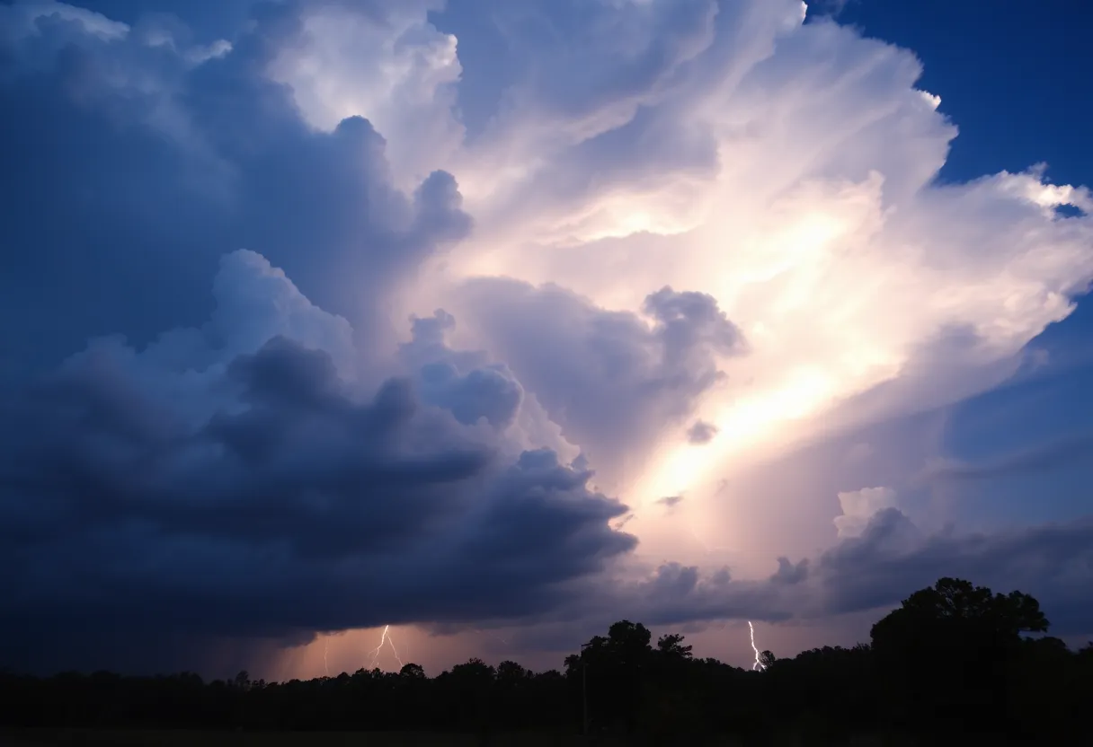
Thunderstorm Risks Looming
As we approach Saturday evening, keep an eye on the sky because the National Weather Service has indicated that thunderstorms could start developing after midday. The rain and storm activity is likely to bubble up right when folks are heading out for their weekend plans, so if you’ve got something on the agenda, be prepared!
Cities like Columbia, Orangeburg, and Sumter stand a 40–45% chance of seeing some of that precipitation, with the southern and western parts of the Midlands facing the highest risks. Just when you thought it was hot enough, we could see high temperatures soaring between 89°F to 92°F in Richland, Lexington, and Aiken. It’s not just about the heat; it could lead to heat-related stress for those outdoors before the storms roll in.
Stay Cool and Hydrated
Experts advise everyone to stay hydrated and limit outdoor activities during the peak heat to avoid any uncomfortable situations. If you’ve got loose outdoor items lying around, now’s the time to secure them because strong winds are expected to accompany the storms.
Be Prepared for Rainy Nights
As the clock ticks towards nightfall, rain chances are projected to decrease, but it’s not quite time to breathe easy. Wet roads and potential power outages may throw a wrench in your morning plans on Sunday. Drivers should be extra cautious, especially in areas prone to storms, as conditions can change rapidly.
Severe Thunderstorm Warnings in Effect
Highlighted areas under the warning include Manning, Alcolu, Paxville, Brogdon, and Foreston, along with significant stretches of I-95 between mile markers 116 and 129.
Staying Safe During Thunderstorms
If you find yourself facing one of these storms, the safest place to be is in an interior room on the lowest floor of your building. With lightning making its strikes about 25 million times a year in the U.S.—most frequently during the humid summer months—being diligent about safety is crucial.
The Risk of Hydroplaning
As rain starts to pour, the risk of hydroplaning goes up, leading to potential loss of vehicle control. Knowing this, all motorists are encouraged to take extra care on the roads this weekend. Keep up with updates as the weather evolves, ensuring you are never caught off guard!
More Weather on the Horizon
And if that wasn’t enough, additional severe weather developments are anticipated throughout the weekend across central and north-central South Carolina. Expect heavy rainfall and potentially high winds exceeding 60 mph at staggered times Saturday night into Sunday morning. Just when you thought the weather couldn’t get any wilder!
So, whatever your weekend plans may be, make sure to stay informed, stay safe, and embrace the wild weather that is characteristic of South Carolina this time of year!
Deeper Dive: News & Info About This Topic
HERE Resources
South Carolina Governor Declares State of Emergency Due to Wildfires
R&B Legends Unite for Columbia Concert and Charity Events
Richland County Invites Public Feedback on Sidewalk Designs
Columbia Prepares for Major Winter Storm with Snowfall Expected
South Carolina Supreme Court Upholds Six-Week Abortion Ban
Columbia, SC Hosts Action-Packed Weekend of Events
Tragic School Bus Crash in Chester County Claims Young Life
Hen’tasia Mclean Joins Columbia College Track and Field Team
Flood Advisories Prompt Infrastructure Upgrades in Columbia, SC
South Carolina Ranks as the Top Growth State for 2024
Additional Resources
- The State: Severe Weather in Central South Carolina
- Wikipedia: Thunderstorm
- WLTX: South Carolina Storm Forecast
- Google Search: South Carolina weather
- Fox Weather: Flooding in North Carolina
- Encyclopedia Britannica: Meteorology
- WYFF: Extreme Hail Threat in SC & NC
- Google News: Severe thunderstorms South Carolina
Author: STAFF HERE LEXINGTON WRITER
The LEXINGTON STAFF WRITER represents the experienced team at HERELexington.com, your go-to source for actionable local news and information in Lexington, Fayette County, and beyond. Specializing in "news you can use," we cover essential topics like product reviews for personal and business needs, local business directories, politics, real estate trends, neighborhood insights, and state news affecting the area—with deep expertise drawn from years of dedicated reporting and strong community input, including local press releases and business updates. We deliver top reporting on high-value events such as Woodland Art Fair, Crave Food and Music Festival, and Railbird Festival. Our coverage extends to key organizations like Commerce Lexington and Blue Grass Community Foundation, plus leading businesses in education, manufacturing, and technology that power the local economy such as University of Kentucky, Toyota Motor Manufacturing, and Lexmark. As part of the broader HERE network, including HEREBowlingGreen.com and HERELouisville.com, we provide comprehensive, credible insights into Kentucky's dynamic landscape.
