News Summary
Columbia, SC is bracing for severe weather on Monday with heavy rain and potential flooding. Rain accumulation may reach 2 inches, impacting temperatures and increasing humidity. Residents are advised to prepare for hazardous conditions and stay informed. A wetter week follows, with rain chances continuing into Tuesday and Wednesday. While no immediate warnings are in place, damaging winds and flash flooding are significant concerns. Cooler temperatures are expected mid-week before a anticipated dry spell.
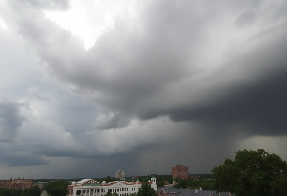
Columbia, SC – A severe weather alert has been issued for Columbia, SC, warning of heavy rain and flooding expected on Monday. Rainy conditions are currently being observed in the Midlands, particularly in southern areas, although drier weather is forecasted to return by Sunday evening. As a precaution, Monday has been designated as a First Alert Weather Day.
In terms of temperature, Columbia recorded a maximum of 71 degrees on Sunday, which is notably 15 degrees below the average for this time of year. Sunday night is anticipated to remain mostly dry, with only a slight chance of isolated showers. Overnight lows are expected to drop into the mid-60s, potentially leading to fog development.
On Monday morning, humidity is set to increase, resulting in a high likelihood of scattered showers throughout the day. Rain accumulation could possibly reach up to 2 inches, with localized amounts potentially higher in areas experiencing thunderstorms. As the system advances, meteorologists predict that temperatures may initially reach the mid-70s before dropping after the storm passes.
Later in the afternoon on Memorial Day, periods of dryness may occur, but the sky will remain predominantly cloudy. High temperatures are expected to be cooler than average, only reaching the upper 70s, with overnight lows falling into the low 60s.
Looking ahead, rain chances are anticipated to linger into the following week. A series of shortwaves, combined with a stationary front positioned to the south, is likely to contribute to increased precipitation, particularly on Tuesday and Wednesday when the highest probabilities for rain have been forecasted. Scattered showers and sporadic storms are projected throughout the week, although the likelihood of rain is expected to decrease as the week progresses.
While severe weather is not currently anticipated, temperatures are projected to rise again starting Wednesday, reaching the mid-80s. Following the precipitation early in the week, a shift to drier conditions is expected after Friday, with temperatures stabilizing at normal levels over the weekend.
Winds and rainfall present the most significant concerns for the upcoming severe weather. The strongest storms are predicted to occur between 1 PM and 7 PM on Monday, primarily impacting areas along and south of the Interstate 20 corridor. Damaging winds and heavy rain leading to flash flooding pose threats particularly in urban environments and flood-prone regions. While no immediate warnings or advisories have been issued, weather conditions are subject to alteration as storms approach the region.
As temperatures drop post-front passage, a transition to a cooler and drier air mass is expected, with highs likely limited to the 60s on Tuesday and Wednesday. Additionally, there’s potential for frost overnight on Tuesday, as temperatures are anticipated to fall into the mid to upper 30s.
Residents are advised to prepare for the anticipated weather conditions, stay informed of any changing forecasts, and remain cautious of potential flooding and storm hazards throughout this period of severe weather.
Deeper Dive: News & Info About This Topic
HERE Resources
Midlands Family Expo to Support Local Families
Dining by the Waterfront: Lake Murray Summer Highlight
Columbia Water to Upgrade Sanitary Sewer System
Columbia to Host Gold Star Memorial Day Parade
Lexington County Community Mourns After Fatal Crash
Lexington County Residents React to Significant Property Valuation Increases
Tragic Car Crash Claims Lives of Two Young Women in Lexington County
Local Athletes Shine in Central City Competitions
Richland County Welcomes Summer with Memorial Day Weekend Events
Duke Energy Appoints New President for South Carolina Operations
Additional Resources
- The State: Severe Weather Alert for Columbia, SC
- Wikipedia: Columbia, South Carolina
- WIS TV: Cool Mother’s Day Weekend Ahead
- Google Search: Columbia SC Weather
- WLTX: South Carolina Weather Forecast
- Encyclopedia Britannica: South Carolina
- Island Packet: Weather Report
- Google News: Columbia SC Flooding

Author: STAFF HERE LEXINGTON WRITER
The LEXINGTON STAFF WRITER represents the experienced team at HERELexington.com, your go-to source for actionable local news and information in Lexington, Fayette County, and beyond. Specializing in "news you can use," we cover essential topics like product reviews for personal and business needs, local business directories, politics, real estate trends, neighborhood insights, and state news affecting the area—with deep expertise drawn from years of dedicated reporting and strong community input, including local press releases and business updates. We deliver top reporting on high-value events such as Woodland Art Fair, Crave Food and Music Festival, and Railbird Festival. Our coverage extends to key organizations like Commerce Lexington and Blue Grass Community Foundation, plus leading businesses in education, manufacturing, and technology that power the local economy such as University of Kentucky, Toyota Motor Manufacturing, and Lexmark. As part of the broader HERE network, including HEREBowlingGreen.com and HERELouisville.com, we provide comprehensive, credible insights into Kentucky's dynamic landscape.
