News Summary
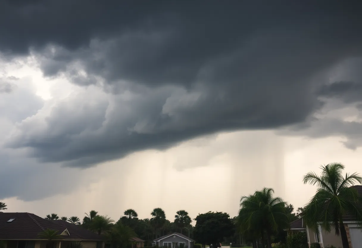
Severe weather swept through the Midlands region, causing widespread power outages and damage on a Thursday afternoon. The National Weather Service had issued early warnings about the storms, which brought damaging winds, hail, and heavy rain. Many counties reported significant impacts, including downed trees and power lines. Schools took precautionary measures by altering their schedules to ensure student safety. Additional storms were expected to follow, raising concerns about flash flooding and potential tornadoes.
Columbia, South Carolina – Severe weather swept through the Midlands region on a recent Thursday, leading to widespread power outages and damage across several counties. By approximately 2:20 p.m., most major outages had been resolved, but significant impacts were reported from the fast-approaching storms.
The National Weather Service had issued warnings about the potential for severe weather in the Columbia area, which commenced on Thursday afternoon. Storms were expected to start between 1 and 3 p.m., with the most adversely affected areas identified as Columbia, extending south toward the South Carolina-Georgia state line, and east toward the coast.
Residents braced for additional storms slated for Friday between 1 and 6 p.m., creating an expectation of widespread impacts across the Midlands. The primary concerns associated with the storms included damaging winds, hail, and heavy rain, which could result in flash flooding, particularly in urban environments. There was also a slight risk of isolated tornadoes, especially on Friday.
Forecasts indicated southwest winds could intensify, reaching up to 15 mph, with gusts potentially peaking at 23 mph. Such strong winds alongside the storms posed a risk to trees and structures, including mobile homes and vehicles, potentially causing significant damage. Furthermore, downed trees could lead to additional power outages as they took out power lines in the process.
Both Thursday and Friday were projected to have considerable rain probabilities, with forecasts of 60% on Thursday, escalating to 90% on Friday. Nearly two inches of precipitation could accumulate, and localized flooding could exceed expectations, especially during intense thunderstorms.
As of late Friday afternoon, reports indicated instances of damage, including downed trees and power lines in regions such as Calhoun, Orangeburg, and Clarendon Counties. There were tornado warnings issued for these areas; however, no tornadoes were confirmed during the event. In Lexington County, significant damage was reported with multiple streets affected by downed trees and power lines, as well as disruptions on Highway 21. Peak outages in Lexington County reached nearly 9,000 before experiencing a decline, while Calhoun and Clarendon counties together reported over 5,600 outages by around 6 p.m.
In anticipation of the severe weather, various school districts took precautionary measures, leading to changes in schedules. Some districts closed entirely, while others delayed their operations or shifted to eLearning days to ensure student safety amid hazardous travel conditions.
Weather forecasts suggest that residents may experience a calmer and drier weekend, with seasonal temperatures expected to reach the low 80s during the day and cooler temperatures at night. Looking further ahead, temperatures may rise again, possibly reaching the 90s by mid-week.
While Thursday’s storms posed a significant threat, the eventual clearing conditions that are expected to follow should provide a welcome reprieve for the Midlands community.
Deeper Dive: News & Info About This Topic
HERE Resources
Columbia, South Carolina Prepares for Thunderstorms and Heat
Storm Causes Destruction in Lexington County, Community Resilient
Severe Thunderstorms Cause Havoc in the Midlands
Severe Weather Alerts Issued for Columbia Area
Columbia, SC Kicks Off Summer with Weekend Events
Charlotte Weekend Events and Weather Alert
Severe Thunderstorm Warnings Hit South Carolina
Proposed High-Rise Towers Set to Transform Downtown Columbia
Columbia SC Braces for Severe Weather Threat
Inclement Weather Cancels Dining on the Dam Event
Additional Resources
- The State: Severe Weather in Midlands
- Wikipedia: Severe Weather
- WLTX: Severe Storms Threat in Midlands
- Google Search: Midlands Severe Weather Impact
- The State: Weather Update
- Encyclopedia Britannica: Weather
- ABC Columbia: School Changes Due to Severe Weather
- Google News: School Delays Due to Severe Weather
- WIS TV: Severe Storms Possible

Author: STAFF HERE LEXINGTON WRITER
The LEXINGTON STAFF WRITER represents the experienced team at HERELexington.com, your go-to source for actionable local news and information in Lexington, Fayette County, and beyond. Specializing in "news you can use," we cover essential topics like product reviews for personal and business needs, local business directories, politics, real estate trends, neighborhood insights, and state news affecting the area—with deep expertise drawn from years of dedicated reporting and strong community input, including local press releases and business updates. We deliver top reporting on high-value events such as Woodland Art Fair, Crave Food and Music Festival, and Railbird Festival. Our coverage extends to key organizations like Commerce Lexington and Blue Grass Community Foundation, plus leading businesses in education, manufacturing, and technology that power the local economy such as University of Kentucky, Toyota Motor Manufacturing, and Lexmark. As part of the broader HERE network, including HEREBowlingGreen.com and HERELouisville.com, we provide comprehensive, credible insights into Kentucky's dynamic landscape.
