News Summary
Severe thunderstorms swept through South Carolina and Georgia, prompting warnings from the National Weather Service. High winds reached up to 50 mph, causing tremors across various counties. The storm included an EF1 tornado that touched down in Elbert County, Georgia, resulting in uprooted trees and significant damage in McCormick County, South Carolina. Residents were urged to seek shelter and avoid driving during the storm. The community is encouraged to report any damage, aiding the NWS in assessments.
Strong Thunderstorms and Tornadoes Rock South Carolina and Georgia
Attention, residents of South Carolina and Georgia! If you were around last night, you might have felt the excitement—or should we say anxiety—of the strong thunderstorms that swept through the region. An updated report from the National Weather Service (NWS) Columbia, SC came out Tuesday evening, letting everyone know about the turbulent weather that was expected to last until about 9 p.m.
Are You Affected?
The alert covers several counties, including McCormick, Edgefield, Saluda, Lexington, and Aiken. With wind gusts hitting speeds of up to 50 mph, things got a bit intense. By 8:07 p.m., Doppler radar had spotted a strong thunderstorm over North Augusta, making its way northeast at 35 mph. Those outside were advised to find shelter inside a sturdy building.
What’s the Impact?
Many popular locations felt the storm’s presence, including Aiken, North Augusta, Evans, Martinez, Augusta, Clearwater, and even the famed Augusta National Golf Club. The list doesn’t stop there; places like Glendale, Johnston, and the USC Aiken campus were also in the bustling storm’s path.
Highways to Avoid
Driving was not recommended during this stormy adventure. Important highways affected included:
- Interstate 20 in Georgia between mile markers 197 and 201
- Interstate 20 in South Carolina between mile markers 0 and 38
- Interstate 520 in South Carolina between mile markers 16 and 23
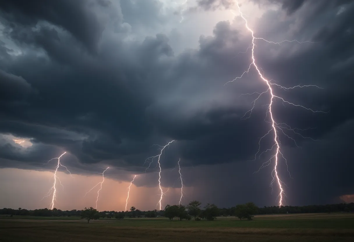
Lightning is truly a force to be reckoned with; it strikes the United States about 25 million times annually! Usually, the peak lightning occurs during the summer months, leading to around 20 fatalities each year. As the thunderstorm approached, the risk of lightning increased. The safe play was to stay indoors until the storm passed.
Safety First!
So, what can you do for safety during such thunderstorms? It’s crucial to seek indoor shelter. If you find yourself driving, make sure to be aware of hydroplaning, which is that slippery situation when water builds up in front of your tires and causes a loss of control. Hydroplaning can be triggered by excessive rain or worsening conditions, so be cautious!
Tornado Touchdown
If you thought the storms couldn’t get any wilder, think again! An EF1 tornado reportedly touched down in Elbert County, Georgia, and made its way into McCormick County, South Carolina at around 7:10 p.m. on Monday. This tornado brought winds roaring up to 105 mph, uprooting trees and causing some chaos at Bobby Brown State Park.
The destruction did not stop there; the damage was particularly noticeable along Bobby Brown State Park Road and intensified as it crossed Ranger Road. There was some confusion about the cause of other damages reported in McCormick and Edgefield Counties, which were linked to strong thunderstorm winds rather than the tornado itself. Debris like snapped and uprooted trees were spotted close to Highway 378 and Highway 283, although it wasn’t as severe as first thought.
Reporting Storm Damage
The NWS faced challenges surveying damage in rural areas, especially given that previous damage was still visible from Hurricane Helene. For anybody living in these regions, your reports are incredibly helpful. Sharing your experiences via social media or email can assist the NWS in understanding the impact and adjusting future warnings.
Stay safe, everyone! With these unpredictable thunderstorms and tornadoes lingering nearby, it’s best to stay updated and be prepared for more weather surprises.
Deeper Dive: News & Info About This Topic
HERE Resources
Severe Thunderstorms Roll Into Kentucky: What You Need to Know!
EF1 Tornado Strikes Lexington County
Severe Weather Hits Columbia: Thousands Left in Darkness
Severe Thunderstorms Cause Power Outages in Columbia
Severe Thunderstorms Cause Power Outages in Columbia, SC
Severe Weather Action in Texas as Emergency Resources Mobilized
Severe Weather in South Carolina Causes Major Power Outages
Severe Weather Strikes Central South Carolina and Michigan
Severe Weather Causes Outages and Damage in Midlands
Columbia, South Carolina Prepares for Thunderstorms and Heat
Additional Resources
- WYFF4: EF1 Tornado Recorded After Recent Storms
- Yahoo: Weather News
- The State: Weather News
- Encyclopedia Britannica: Tornado
- WRDW: NWS Surveys Monday’s Storm Damage
- Google News: Tornado South Carolina
Author: STAFF HERE LEXINGTON WRITER
The LEXINGTON STAFF WRITER represents the experienced team at HERELexington.com, your go-to source for actionable local news and information in Lexington, Fayette County, and beyond. Specializing in "news you can use," we cover essential topics like product reviews for personal and business needs, local business directories, politics, real estate trends, neighborhood insights, and state news affecting the area—with deep expertise drawn from years of dedicated reporting and strong community input, including local press releases and business updates. We deliver top reporting on high-value events such as Woodland Art Fair, Crave Food and Music Festival, and Railbird Festival. Our coverage extends to key organizations like Commerce Lexington and Blue Grass Community Foundation, plus leading businesses in education, manufacturing, and technology that power the local economy such as University of Kentucky, Toyota Motor Manufacturing, and Lexmark. As part of the broader HERE network, including HEREBowlingGreen.com and HERELouisville.com, we provide comprehensive, credible insights into Kentucky's dynamic landscape.
