News Summary
Residents in South Carolina are preparing for severe thunderstorms as the National Weather Service issues a warning for several counties. Wind gusts could reach up to 60 mph, and the storm is rapidly approaching areas like Manning and Summerton. Drivers should be cautious on affected interstates due to potential dangers from fallen trees and power lines. Additionally, the threat extends into the weekend, with risks of more storms and hail predicted. Safety measures are crucial as conditions worsen, prompting authorities to advise seeking shelter indoors.
Severe Thunderstorms Loom Over South Carolina
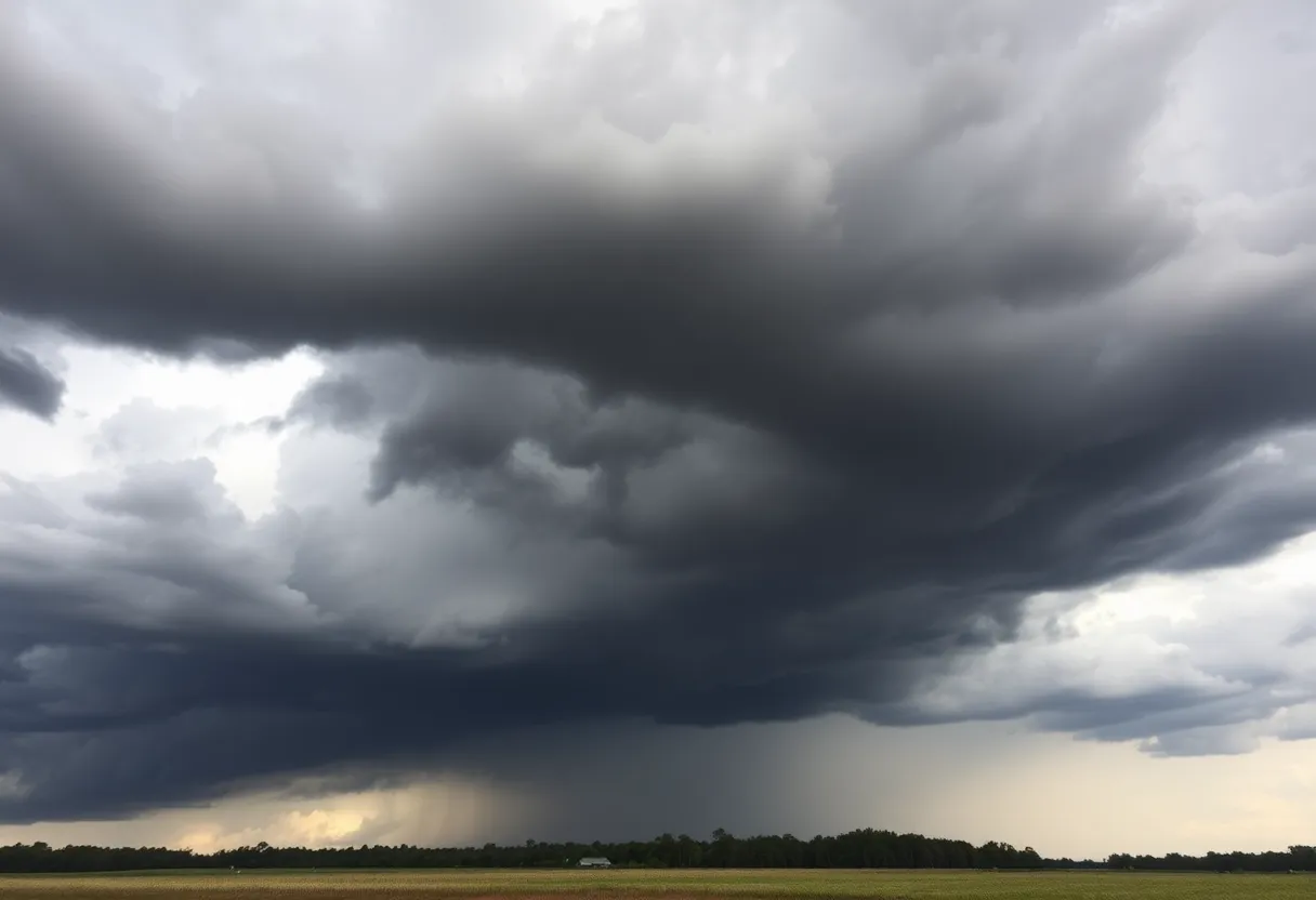
As the clock ticks closer to the evening hours, residents in South Carolina are bracing themselves for some turbulent weather. The National Weather Service has issued an updated severe thunderstorm warning effective until 7 p.m. for residents in Calhoun, Clarendon, and Orangeburg counties. This is not just your average summer thunderstorm; wind gusts could reach a whopping 60 mph, leading to potential damage in the area.
What’s Happening Right Now
At around 6:15 p.m., meteorologists tracked a serious storm brewing just near Holly Hill, which is approximately 15 miles north of Saint George. This storm is moving rapidly to the east at about 25 mph. This development means that spots like Manning, Summerton, and, of course, Holly Hill should be preparing for the onslaught of wind and rain that could very well change the landscape.
Road Safety Concerns
For anyone planning to travel, you might want to reconsider. Interstate 26 and Interstate 95 are both expected to be impacted, particularly between mile markers 164 to 169 and 85 to 117, respectively. Tips for those on the road include keeping an eye out for trees and powerlines that might come crashing down from the storm, potentially causing dangerous situations.
Play It Safe
In light of these warnings, safety should be your top priority. The National Weather Service advises moving to an interior room on the lowest floor of your building if the storm arrives, ensuring you’re away from any windows. This precaution is crucial as the storm could lead to flying debris and other dangerous conditions.
Looking Ahead: Weekend Woes
But wait, there’s more! The severe thunderstorm watch does not end tonight. In fact, the Storm Prediction Center has indicated a slight risk for more severe weather across South Carolina this weekend. With high temperatures possibly reaching into the low 90s, conditions are ripe for additional thunderstorms that could produce wind gusts over 50 mph and hail—yes, HAIL—up to half an inch in diameter. It’s shaping up to be a wet and wild weekend!
Understanding the Thunderstorm Threat
Did you know that on average, around 25 million lightning strikes occur across the U.S. each year? This seemingly impressive number comes with a serious side-effect; lightning claims about 20 lives annually. As a thunderstorm approaches, the chances of lightning increase, reaching a peak when the storm actually hits. So, it’s best to stay inside and enjoy the show from a safe distance.
Ready, Set, Hydroplane?
Finally, a heads-up for those who may be driving during heavy rain: hydroplaning is a serious concern. This phenomenon takes place when vehicles lose traction on wet roads, causing them to slide uncontrollably. The risk of hydroplaning is influenced by several factors, such as tire tread depth, vehicle speed, and current road conditions. Maintain caution, particularly when heavy rain arrives!
Your Thunderstorm Survival Kit
As you gear up for these storms, make sure to keep safety in mind. Remember, seeking indoor shelter and steering clear of those slippery roads is essential. It’s always better to be safe than sorry when Mother Nature decides to put on a show. Stay dry and safe out there!
Deeper Dive: News & Info About This Topic
HERE Resources
Severe Thunderstorm Warnings Issue for South Carolina
Flash Flood Warning Initiated for Lexington and Saluda Counties
Severe Thunderstorm Watch Issued for Midlands Area
Tropical Storm Chantal Approaches South Carolina Coast
Lake Wind Advisory Issued for South Carolina Counties
Severe Thunderstorm Alerts Sweep Across South Carolina
Water Service Disruptions in Lexington County
Strong Thunderstorms on the Horizon for Orangeburg County
Severe Thunderstorm Warning Hits Columbia, SC
Vintage Cars Converge at the 2025 Great Race Finale
Additional Resources
- The State
- Wikipedia: Thunderstorm
- WIS TV
- Google Search: Severe Thunderstorms South Carolina
- WLTX
- Encyclopedia Britannica: Thunderstorm
- WACH
- Google News: Thunderstorm Warnings South Carolina
Author: STAFF HERE LEXINGTON WRITER
The LEXINGTON STAFF WRITER represents the experienced team at HERELexington.com, your go-to source for actionable local news and information in Lexington, Fayette County, and beyond. Specializing in "news you can use," we cover essential topics like product reviews for personal and business needs, local business directories, politics, real estate trends, neighborhood insights, and state news affecting the area—with deep expertise drawn from years of dedicated reporting and strong community input, including local press releases and business updates. We deliver top reporting on high-value events such as Woodland Art Fair, Crave Food and Music Festival, and Railbird Festival. Our coverage extends to key organizations like Commerce Lexington and Blue Grass Community Foundation, plus leading businesses in education, manufacturing, and technology that power the local economy such as University of Kentucky, Toyota Motor Manufacturing, and Lexmark. As part of the broader HERE network, including HEREBowlingGreen.com and HERELouisville.com, we provide comprehensive, credible insights into Kentucky's dynamic landscape.
