News Summary
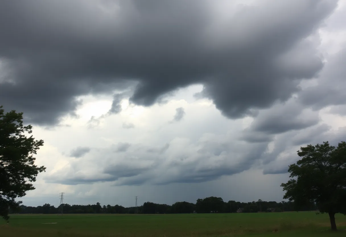
Residents in Edgefield, Saluda, Lexington, and Aiken counties of South Carolina faced severe thunderstorm warnings this Saturday evening. The National Weather Service issued an alert lasting until 10:15 p.m. The storm, moving southeast at 20 mph, poses threats of strong winds, flying debris, and flash flooding. Travelers on major highways are advised to exercise caution, while safety tips highlight the risks of hydroplaning. With a history of significant thunderstorms recently, residents are urged to stay informed and safe.
Severe Thunderstorm Warnings Sound Alarm in South Carolina
Residents of South Carolina, particularly in the charming counties of Edgefield, Saluda, Lexington, and Aiken, were given a heads-up on Saturday evening as the National Weather Service issued severe thunderstorm warnings. This alert, posted at 9:23 p.m., spans until 10:15 p.m., creating a sense of urgency for those planning to venture out or engage in weekend festivities.
A Storm on the Move
The storm, which has been making waves on the radar, was tracked over the Ridge Spring area, located about 8 miles west of Batesburg-Leesville. The system is churning southeast at a steady pace of 20 mph, captivating the attention of weather watchers. With wind gusts that could hit up to 50 mph, precautions are surely in order to avoid any surprises during this unsettled weather.
Watch Out for Flying Debris
As the winds pick up speed, residents should brace for the potential of tree limbs flying and unsecured items getting caught in the storm’s crosswinds. Popular spots in the impact zone include bustling cities like Aiken, North Augusta, and Batesburg-Leesville, along with notable locations such as Strom Thurmond High School, USC Aiken, and various municipal airports. Safety is paramount, and folks are advised to find shelter indoors as the storm approaches.
Highways Under the Radar
Driving? Beware! Major highways like Interstate 20 and Interstate 520 are also feeling the storm’s impact, especially between specific mile markers. If you’re on the road, it’s best to plan ahead and stay safe as the gusty winds and potential for slippery conditions roll in.
Lightning: A Serious Threat
One thing to keep in mind when it comes to thunderstorms is lightning. Did you know that lightning strikes the United States a staggering 25 million times a year? South Carolina residents should take extra care during storms as the risk of lightning increases significantly. When thunder roars and lightning flashes, it’s time to hunker down and ride it out indoors.
Flash Flood Risk
Heavy rains can lead to flash flooding, creating treacherous conditions on roads. If you encounter flooded areas, make sure to steer clear and not attempt to drive through. Remember, it’s always better to wait and stay dry than to gamble with your safety.
A Look Back at Wednesday’s Storm
Driving Safety Tips
With the threat of hydroplaning looming during storms, drivers should be cautious. Hydroplaning occurs when a vehicle loses traction with the road due to pools of water. This can lead to an unexpected and scary situation where the car slides uncontrollably. Remember to reduce speed and avoid sudden movements of the steering wheel when driving in rainy conditions!
What’s Next?
Stay safe, South Carolina! Weathering storms can be a challenge, but with the right information and precautions, we can all ride out the tempest together.
Deeper Dive: News & Info About This Topic
HERE Resources
Severe Weather Warnings and Tornadoes Hit South Carolina
Severe Thunderstorm Warning for Lexington County Now Over
Lancaster University Issues Severe Thunderstorm Alert
Severe Thunderstorms Loom Over South Carolina
Severe Thunderstorm Warnings Issue for South Carolina
Flash Flood Warning Initiated for Lexington and Saluda Counties
Severe Thunderstorm Watch Issued for Midlands Area
Tropical Storm Chantal Approaches South Carolina Coast
Lake Wind Advisory Issued for South Carolina Counties
Severe Thunderstorm Alerts Sweep Across South Carolina
Additional Resources
- Herald Online
- Wikipedia: Severe Thunderstorm
- Island Packet
- Google Search: Thunderstorm South Carolina
- WRDW
Author: STAFF HERE LEXINGTON WRITER
The LEXINGTON STAFF WRITER represents the experienced team at HERELexington.com, your go-to source for actionable local news and information in Lexington, Fayette County, and beyond. Specializing in "news you can use," we cover essential topics like product reviews for personal and business needs, local business directories, politics, real estate trends, neighborhood insights, and state news affecting the area—with deep expertise drawn from years of dedicated reporting and strong community input, including local press releases and business updates. We deliver top reporting on high-value events such as Woodland Art Fair, Crave Food and Music Festival, and Railbird Festival. Our coverage extends to key organizations like Commerce Lexington and Blue Grass Community Foundation, plus leading businesses in education, manufacturing, and technology that power the local economy such as University of Kentucky, Toyota Motor Manufacturing, and Lexmark. As part of the broader HERE network, including HEREBowlingGreen.com and HERELouisville.com, we provide comprehensive, credible insights into Kentucky's dynamic landscape.


