News Summary
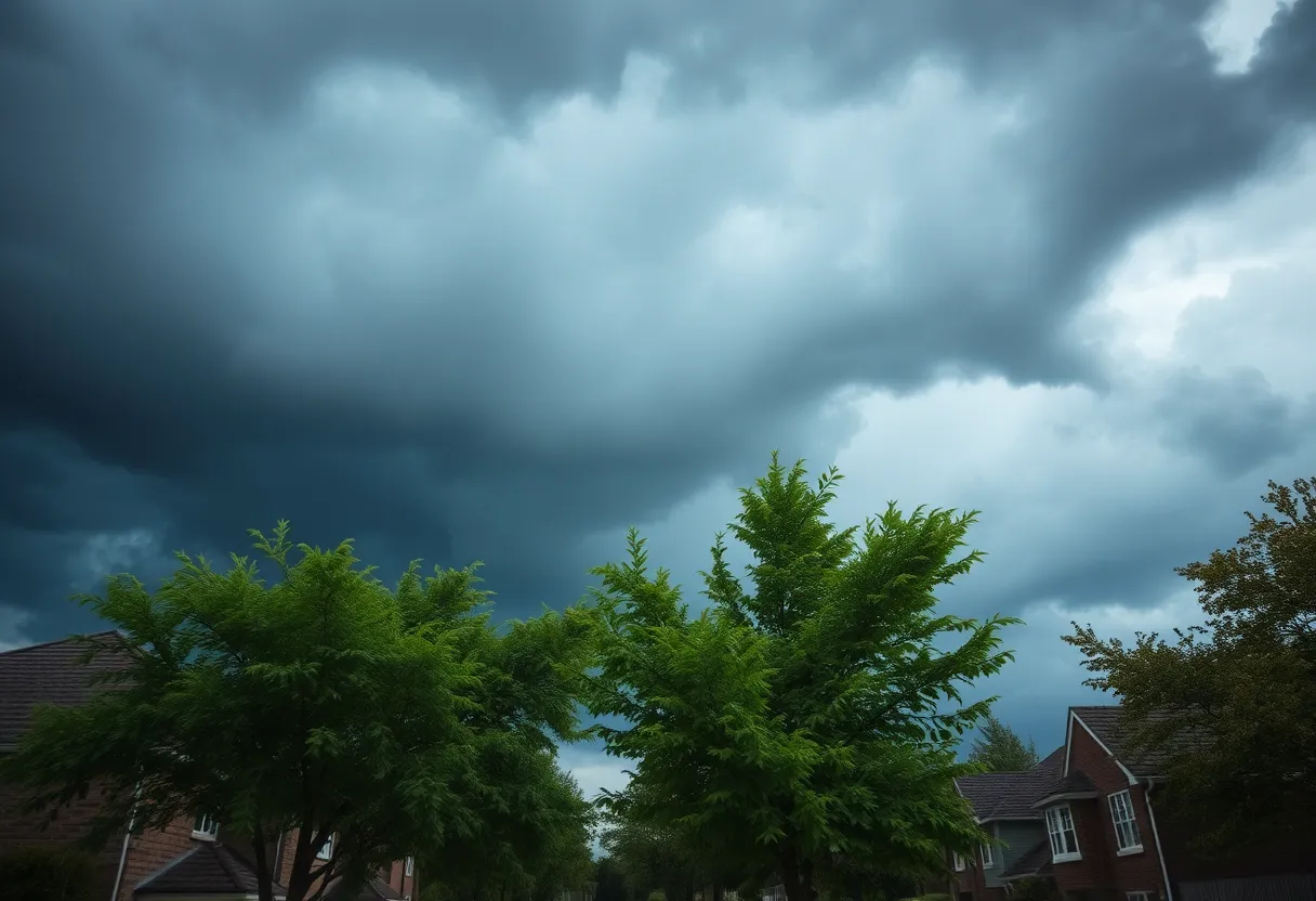
Columbia and Lexington Counties are under severe thunderstorm and tornado warnings as powerful storms approach, bringing winds potentially exceeding 60 mph. Residents are urged to take shelter and stay safe as the storm is expected to cause damage, including downed trees and power outages. The National Weather Service has alerted the community to remain vigilant and prepared for rapidly changing conditions throughout the day.
Severe Thunderstorm and Tornado Warnings Rock Columbia and Lexington Counties
Columbia is bracing itself today as both a severe thunderstorm warning and a tornado warning have been issued for Columbia and Lexington County. The National Weather Service has alerted residents to be on high alert as these weather systems pack quite a punch. The tornado warning will remain in effect until 8 a.m., while the severe weather warning extends until 8:30 a.m. This is not a drill!
Powerful Winds on the Way
Hold onto your hats, folks! The storm is bringing winds that could ramp up to a jaw-dropping 60 mph across Columbia, Lexington, Cayce, and West Columbia. But that’s not all; there’s a shining potential for those wind gusts to soar above 74 mph in the eastern Midlands, exactly where tornadoes are expected to most likely be brewing.
In the Path of the Storm
The tornado warning isn’t just limited to the original areas mentioned—it’s also covering regions like Irmo and Chapin. Residents should be especially vigilant! The dangerous storms are predicted to make their move close to South Congaree, Springdale, and Red Bank around 7:40 a.m., heading toward places like West Columbia, Gaston, Pine Ridge, and the Columbia Metropolitan Airport by 7:45 a.m. It’s a good idea to stay tuned to updates and be prepared to find shelter.
Take Shelter and Stay Safe
Safety first! The National Weather Service is urging everyone in the affected area to take shelter. If you have a basement, now is the time to head down there. If that’s not an option, find an interior room on the lowest floor of your house that can withstand stormy conditions. Those who are out and about, in mobile homes, or driving should rush to the nearest substantial shelter to avoid any flying debris that could become dangerous.
Be Aware of Potential Damage
With these strong winds and possible tornadoes, there could be severe damage to trees, roofs, and vehicles. Downed trees and branches can lead to knocked-out power lines, causing power outages in various areas. The storm doesn’t just stop at Columbia and Lexington Counties; it could extend its reach into Richland County and other nearby regions, including Fairfield, Newberry, and Saluda Counties.
Stay Updated and Prepared
The winds this morning may not be the only concern—many places will see regular winds gusting up to 25 mph, with some gusts potentially nearing 50 mph. And rain? You bet! There’s a predicted 100% chance of rain throughout the day, with total rainfall projected to be around three-quarters of an inch, although localized areas could see even more. Add in the possibility of pea-sized hail, and it looks like we’re in for quite a chaotic morning.
Don’t Forget Your Safety Plan
The storm effects are expected to linger in the Columbia area until around 11 a.m., with bad weather potentially stretching further into the early afternoon. Keeping yourself and your family safe is the top priority. As this situation evolves, stay alert for further updates, and always be prepared to act if needed!
Deeper Dive: News & Info About This Topic
HERE Resources
Severe Thunderstorms Impact Midlands Residents
Charleston Faces Tropical Storm Debby’s Impact
USC Reverses Class Cancellations Ahead of Winter Weather
Lake Wind Advisory Impacts Central South Carolina and East Central Georgia
Severe Weather Warning: Tornado Watches for Georgia and South Carolina
New Year’s Eve and Day Events in Columbia
Columbia Under Tornado Watch as Severe Thunderstorms Approach
Lake Wind Advisory Issues for Central South Carolina
Columbia on Alert: Tornado Watch Issued as Severe Thunderstorm Threat Looms
Weather Alert: Tornado Watch Issued for Central and Southeast South Carolina
Additional Resources
- The State
- Wikipedia: Tornado Warning
- ABC Columbia
- Google Search: Severe Weather Columbia South Carolina
- Post and Courier
- Encyclopedia Britannica: Severe Weather
- WLTX
- Google News: Columbia South Carolina Tornado

Author: STAFF HERE LEXINGTON WRITER
The LEXINGTON STAFF WRITER represents the experienced team at HERELexington.com, your go-to source for actionable local news and information in Lexington, Fayette County, and beyond. Specializing in "news you can use," we cover essential topics like product reviews for personal and business needs, local business directories, politics, real estate trends, neighborhood insights, and state news affecting the area—with deep expertise drawn from years of dedicated reporting and strong community input, including local press releases and business updates. We deliver top reporting on high-value events such as Woodland Art Fair, Crave Food and Music Festival, and Railbird Festival. Our coverage extends to key organizations like Commerce Lexington and Blue Grass Community Foundation, plus leading businesses in education, manufacturing, and technology that power the local economy such as University of Kentucky, Toyota Motor Manufacturing, and Lexmark. As part of the broader HERE network, including HEREBowlingGreen.com and HERELouisville.com, we provide comprehensive, credible insights into Kentucky's dynamic landscape.