Augusta, August 12, 2025
News Summary
Augusta has issued a Flood Advisory amid predictions of heavy rainfall due to Tropical Storm Erin. Residents should prepare for possible flooding, power outages, and scattered storms over the next few days. With the potential for 3-6 inches of rain from Tropical Storm Helene, it’s important to stay alert and ready for changing weather conditions. Local authorities are monitoring the situation closely and urge citizens to remain prepared for severe weather events.
Augusta Faces Flood Advisory as Tropical Storm Erin Looms
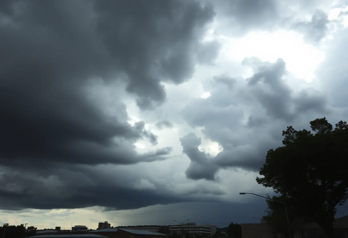
Hey there, Augusta! If you’ve looked outside today, you might have noticed the cloudy skies accompanied by a warm temperature of around 88°F. It’s definitely a day where you might want to grab that umbrella! Tonight, a light shower or a thunderstorm could pop up, and the low is expected to drop to a comfy 74°F. So, don’t put those raincoats back in the closet just yet!
Now, let’s talk about the big news: a Flood Advisory has been issued for the Augusta Metro area, and it’s effective until 12 AM on Monday. With a 40% chance of rain hovering over us, we could see a bit of rain showering down off and on this evening. Expect at least an additional 1 to 1.5 inches of rainfall overnight, which might lead to some short-lived road ponding in areas where the rain hits hardest.
What’s Coming Next?
Tomorrow is shaping up to be another cloudy day. As you head out on Tuesday morning, expect temperatures in the low to mid 70s. Light showers could greet you in the morning, but don’t worry—nothing too drastic yet! As we ease into the afternoon, scattered storms might join the mix, keeping high temperatures in the mid to upper 80s.
But wait, there’s more! If the rain sticks around in your neighborhood, you might just see another 1 to 1.5 inches of rainfall throughout the day. So, prepare those rain boots if you plan to head out!
Upcoming Weather Trends
As we peer into Wednesday, get ready for the cloudy and wet weather to finally clear up a bit. Those gloomy skies should start to fade away, giving way to sunnier days moving forward. Expect some hit-or-miss storms on Wednesday afternoon and evening, but great news—temperatures will flirt with the 90°F mark from Thursday right through the weekend!
As for the tropical scene, we’re seeing increased activity with Tropical Storm Erin forming off the coast of Africa. Erin may even strengthen into a major hurricane by Saturday. Here’s the good news: Erin is predicted to turn out to sea, likely steering clear of the Continental U.S. But wait—there’s another storm in the lineup! Tropical Storm Helene is on everyone’s radar, projected to strengthen significantly and bring heavy rainfall to the Augusta area.
With Helene, brace yourself for a potential downpour of 3-6 inches of rain, along with wind gusts ranging from 39-50 mph. The risk for tornadoes is on the table too, especially as the storm moves into Georgia. It’s time to prepare for possible power outages and perhaps reschedule any nonessential travel plans.
Staying Prepared
Georgia Emergency Management is stressing the importance of being prepared. Make sure your devices are charged and pick a reliable weather alert system to stay in the loop! Additionally, a flood watch has been implemented for the CSRA from 8 AM Thursday until 2 PM Friday. School districts across the area are keeping an eye on the conditions, and some after-school activities may be canceled depending on safety needs.
Local emergency management teams in Augusta and Richmond County are working diligently to address any potential impacts from the storm, especially considering the significant flood risk and anticipated flash flooding in many areas. Keep an eye out, stay prepared, and let’s ride out these tropical storms together!
FAQs
What is the Flood Advisory for Augusta?
A Flood Advisory has been issued for the Augusta Metro area, effective until 12 AM on Monday, predicting heavy rainfall that could cause minor flooding.
How much rainfall can we expect?
Residents can expect an additional 1 to 1.5 inches of rain overnight, with the potential for the same amount on Tuesday.
What preparations should residents make for Tropical Storm Helene?
Residents should prepare for possible flooding and power outages, ensure devices are charged, and consider avoiding nonessential travel.
Key Weather Features
| Feature | Details |
|---|---|
| Current Temperature | 88°F |
| Tonight’s Low | 74°F |
| Rainfall Amount Overnight | 1-1.5 inches |
| Wind Gusts | 39-50 mph |
| Tropical System | Tropical Storm Helene |
| Flood Watch | Effective from 8 AM Thursday until 2 PM Friday |
Deeper Dive: News & Info About This Topic
HERE Resources
South Carolina Prepares for Thunderstorms Amid Summer Heat
Severe Thunderstorm Warnings Sound Alarm in South Carolina
Severe Thunderstorm Warnings Issue for South Carolina
Severe Thunderstorm Warning for Aiken and Lexington Counties
Lexington County Braces for Winter Wonderland Woes
Additional Resources
- Augusta Chronicle: Tropical Storm Helene Expected to Make Landfall
- WJBF: Tracking a Tropical System
- Augusta Press: Tropical Storm Warning Issued for CSRA
- Fox Weather: Hurricane Helene Damage Reports
- Augusta Chronicle: Hurricane Milton Update
- Wikipedia: Tropical Cyclone
- Google Search: Tropical Storms
- Google Scholar: Tropical Storm Impacts
- Encyclopedia Britannica: Tropical Storm
- Google News: Tropical Storm Helene
Author: STAFF HERE LEXINGTON WRITER
The LEXINGTON STAFF WRITER represents the experienced team at HERELexington.com, your go-to source for actionable local news and information in Lexington, Fayette County, and beyond. Specializing in "news you can use," we cover essential topics like product reviews for personal and business needs, local business directories, politics, real estate trends, neighborhood insights, and state news affecting the area—with deep expertise drawn from years of dedicated reporting and strong community input, including local press releases and business updates. We deliver top reporting on high-value events such as Woodland Art Fair, Crave Food and Music Festival, and Railbird Festival. Our coverage extends to key organizations like Commerce Lexington and Blue Grass Community Foundation, plus leading businesses in education, manufacturing, and technology that power the local economy such as University of Kentucky, Toyota Motor Manufacturing, and Lexmark. As part of the broader HERE network, including HEREBowlingGreen.com and HERELouisville.com, we provide comprehensive, credible insights into Kentucky's dynamic landscape.


