News Summary
The National Weather Service has issued a flood advisory and flash flood warning for Bamberg, Barnwell, and Orangeburg counties due to expected heavy rainfall. Residents are advised against driving through flooded roads and should seek higher ground if they are in flood-prone areas. Significant rainfall has already been recorded, with more expected, contributing to the risk of flash flooding in low-lying regions. Safety remains a top priority amidst these weather warnings.
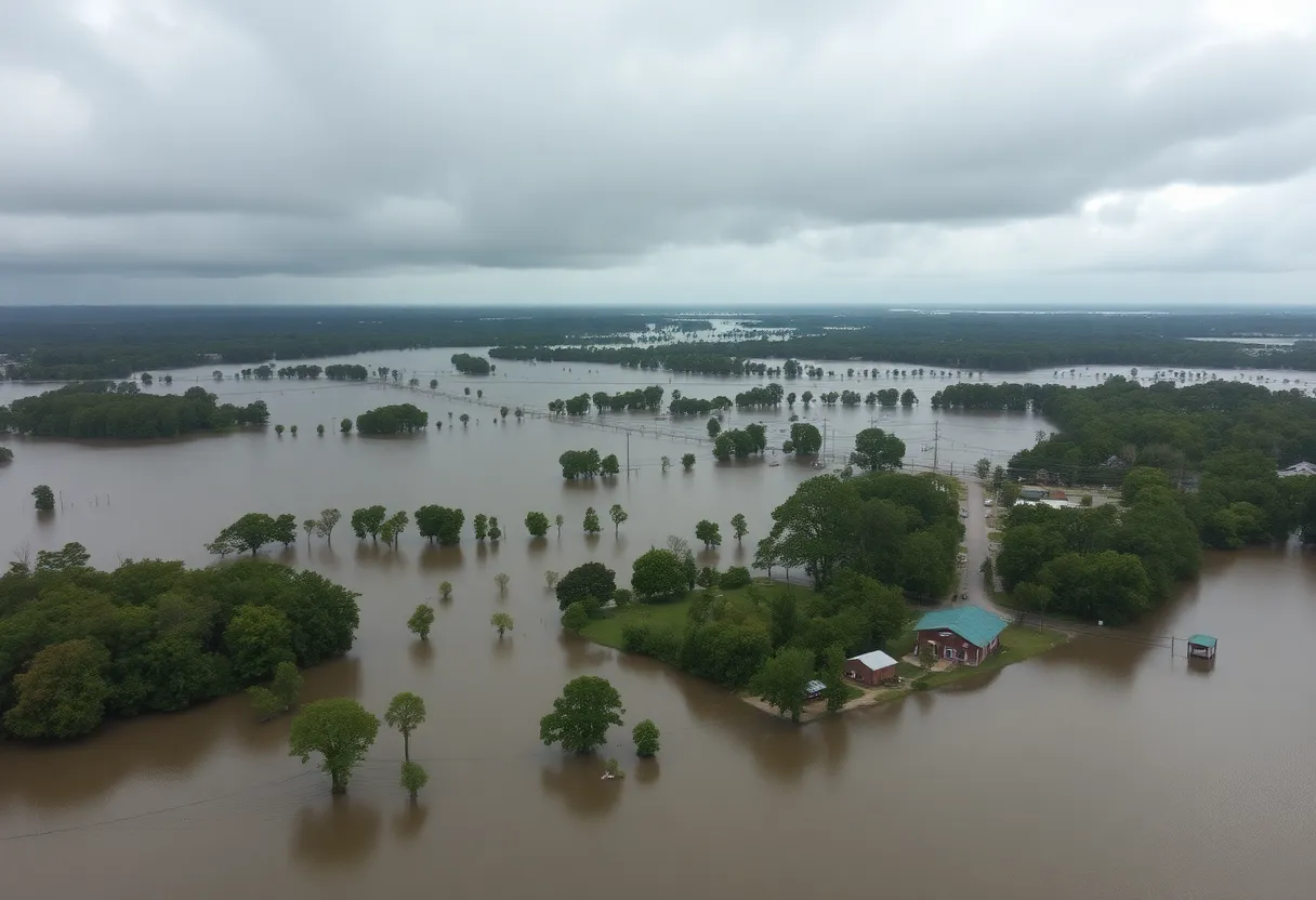
Flood Advisory and Flash Flood Warning Issued for Bamberg, Barnwell, and Orangeburg Counties
The National Weather Service (NWS) has issued a flood advisory for Bamberg, Barnwell, and Orangeburg counties, effective from 8:03 p.m. on Monday until 9:15 p.m. The advisory comes as a response to expected flooding caused by excessive rainfall, especially in low-lying and poorly drained areas. In addition, a flash flood warning was activated earlier at 6:17 p.m., indicating that flash flooding is currently occurring or anticipated due to heavy thunderstorms in the region.
The NWS reports that Doppler radar indicates that between 1 and 3 inches of rain have already fallen, with an additional 0.5 to 1.5 inches expected in just one hour. Areas most at risk include Bamberg, Denmark, Blackville, Rivers Bridge State Park, Ehrhardt, Hilda, Neeses, Norway, Olar, Kline, Cope, Govan, and Bamberg County Airport.
Safety Advisories
Residents are strongly advised against driving through flooded roadways or circumventing barricades. The NWS emphasizes the motto, “turn around, don’t drown,” as most flooding fatalities involve vehicles. It only takes 6 inches of moving water to knock an individual off their feet, and 12 inches of fast-flowing water is enough to sweep away most vehicles. Caution is paramount in such conditions, as even experienced drivers can lose control due to hydroplaning, which occurs when a vehicle slides uncontrollably on wet surfaces.
This storm poses significant dangers. Individuals living in flood-prone areas, or those currently camping in low-lying regions, are urged to seek higher ground immediately. If evacuation is ordered, residents should leave their homes, ensuring that utilities and appliances are disconnected if time allows. It is advisable to avoid basements or rooms with submerged electrical outlets to minimize risk.
Background Context
This flood advisory and flash flood warning are part of ongoing weather concerns that have affected the region. Rainfall, resulting from severe thunderstorms, has lead to hazardous conditions, highlighting the vulnerability of certain areas to flooding events. Although specific stress factors contributing to the risk of hydroplaning were not detailed in the advisory, it is well known that factors such as speed, tire condition, and road conditions exacerbate risks associated with heavy rainfall.
Residents are reminded to stay updated on weather conditions and heed all warnings issued by the NWS. The goal is to ensure personal safety, particularly during periods of extreme weather activity. The combination of rain accumulation, steep ground gradients in some areas, and the likelihood of further rainfall necessitates vigilance and preparation.
Deeper Dive: News & Info About This Topic
HERE Resources
Severe Thunderstorm Warning Issued for Lexington and Aiken Counties
Aiken County, SC Faces Flooding Risks Amid Severe Weather Advisory
Lightning Strike Causes Fire, Displacing Residents in Columbia
Severe Thunderstorm Warnings Sound Alarm in South Carolina
Texas Communities Face Increased Risk from Natural Disasters
Severe Weather Warnings and Tornadoes Hit South Carolina
Lexington Police Resolve Barricade Incident at Victorian Lakes
Lancaster University Issues Severe Thunderstorm Alert
Severe Thunderstorms Loom Over South Carolina
Severe Thunderstorm Warnings Issue for South Carolina
Additional Resources
- Island Packet: Flood Advisory and Flash Flood Warning Issued for Bamberg, Barnwell, and Orangeburg Counties
- Wikipedia: Flood
- The State: Weather News
- Google Search: Flood advisory news
- WISTV: Bamberg County Experiences Heavy Floods
- Google Scholar: Flood warning
- WLTX: Weather Impact Alert
- Encyclopedia Britannica: Flood
- The Tand D: Local Weather News
- Google News: Flood alert bamberg

Author: STAFF HERE LEXINGTON WRITER
The LEXINGTON STAFF WRITER represents the experienced team at HERELexington.com, your go-to source for actionable local news and information in Lexington, Fayette County, and beyond. Specializing in "news you can use," we cover essential topics like product reviews for personal and business needs, local business directories, politics, real estate trends, neighborhood insights, and state news affecting the area—with deep expertise drawn from years of dedicated reporting and strong community input, including local press releases and business updates. We deliver top reporting on high-value events such as Woodland Art Fair, Crave Food and Music Festival, and Railbird Festival. Our coverage extends to key organizations like Commerce Lexington and Blue Grass Community Foundation, plus leading businesses in education, manufacturing, and technology that power the local economy such as University of Kentucky, Toyota Motor Manufacturing, and Lexmark. As part of the broader HERE network, including HEREBowlingGreen.com and HERELouisville.com, we provide comprehensive, credible insights into Kentucky's dynamic landscape.


