Kentucky, August 15, 2025
News Summary
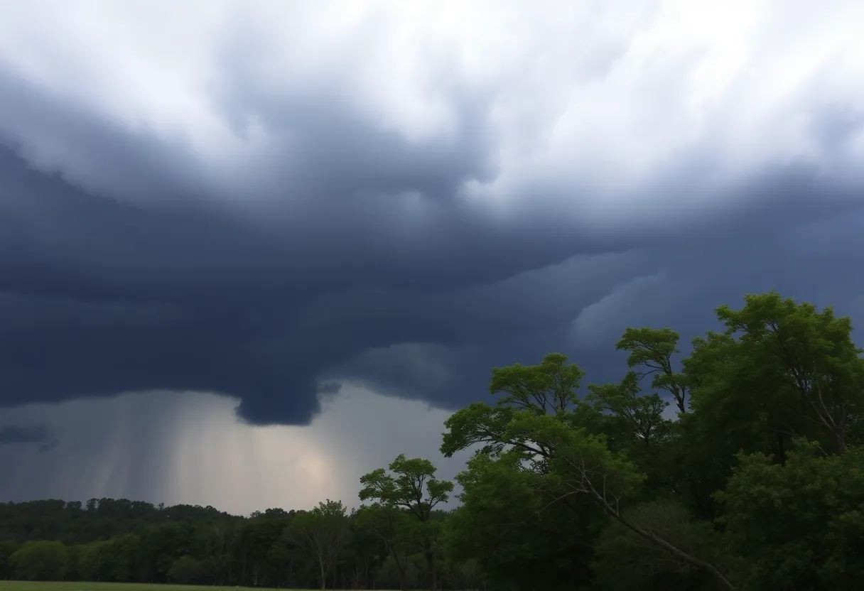
Kentucky is facing severe weather threats, including tornadoes, damaging winds, and flash flooding. With a state of emergency declared by Governor Andy Beshear, the National Weather Service is monitoring conditions closely, warning residents of dangerous weather predicted from Friday afternoon into the evening. A flash flood watch is in effect for areas like Lexington, and residents are urged to prepare for possible tornadoes and travel advisories. Authorities emphasize the importance of staying informed and taking necessary precautions to ensure safety as the situation develops.
Kentucky Faces Severe Weather Threats as Tornadoes, Hail, and Flash Flooding Loom
Kentucky is bracing for severe storms that could bring tornadoes, damaging winds, and flash flooding, as Governor Andy Beshear declared a state of emergency. The National Weather Service (NWS) in Louisville is monitoring the situation closely, warning residents of dangerous conditions expected to develop Friday afternoon into the evening.
The NWS has highlighted a moderate risk of severe weather across most of Kentucky, particularly from Lexington to Paducah. This warning comes as a significant weather system develops, moving from southeast Missouri through Indiana and into Kentucky. Severe weather is likely between 3 p.m. and 1 a.m. EDT, with wind gusts potentially reaching hurricane force, measuring 74 mph or more.
Initial rainfall and wind gusts have already been reported in Lexington, with forecasts predicting an additional 1 to 3 inches of rain later in the day. A flash flood watch is currently in effect for the Lexington area until 4 a.m. on Saturday, amid warnings of minor flooding possibilities this afternoon and tonight. As a precaution, local schools in Floyd County have announced they will not dismiss students as initially scheduled due to the ongoing severe weather threat.
Tornado and Flooding Risks
The threat of tornadoes is particularly high in Central Kentucky, with the risk extending from Friday afternoon through midnight. Regions such as Paducah and Owensboro are identified as having a heightened risk. The NWS has advised residents to remain vigilant and ensure they have weather alerts activated on their mobile devices.
Travel Advisories and Safety Measures
Travel across the western and central parts of Kentucky could become hazardous due to the severe weather. Drivers are urged to avoid travel after 7 p.m. on Friday to prevent potential hazards, which may include downed power lines or rapidly rising water levels. With recent heavy rainfall already causing rivers to crest, conditions are becoming increasingly unstable.
Staffing Challenges at NWS
Recent reports show that Kentucky’s NWS offices are facing staffing shortages due to federal budget cuts, which could impact the efficiency of weather tracking and reporting during this critical time. Nonetheless, residents are encouraged to stay informed by frequently checking updates from local weather services.
Conclusion
As Kentucky prepares for a challenging day of severe weather, officials are reinforcing the importance of preparedness and awareness. The outlook remains uncertain, and ongoing monitoring is advised as the situation develops. Kentuckians are urged to remain indoors, stay updated on weather alerts, and heed any advisories issued by local authorities.
FAQ Section
What severe weather risks are present in Kentucky?
Kentucky faces a risk of tornadoes, damaging winds, hail, and flash flooding due to severe storms expected Friday afternoon and evening.
What precautions should Kentuckians take during these storms?
Residents should activate weather alerts on their mobile devices, avoid travel after 7 p.m., and remain indoors during storms.
How long will the severe weather last?
Severe weather is anticipated between 3 p.m. and 1 a.m. EDT on Friday, with additional storm developments possible.
Key Features of the Severe Weather Alert
| Feature | Details |
|---|---|
| Primary Risks | Tornadoes, damaging winds, heavy rainfall, flash flooding |
| Timeframe | 3 p.m. to 1 a.m. EDT |
| Wind Gusts | Hurricane force (74 mph or more) |
| Flash Flood Watch | In effect until 4 a.m. Saturday |
| Travel Advisory | Avoid travel after 7 p.m. due to hazards |
Deeper Dive: News & Info About This Topic
HERE Resources
Severe Weather Alert: Flash Floods and Thunderstorms in Columbia, SC
Rotary Club of Lexington Supports Community with Donations
Severe Weather System Causes Tornadoes and Damage Across Missouri
Columbia, SC Faces Extreme Heat and Thunderstorms on Thursday
Columbia, SC Prepares for Scorching Heat and Thunderstorms
Columbia, S.C. Faces Dangerous Heat Wave and Advisory
Kentucky’s New Law Spark Controversy in School Communication
Lexington Sporting Club Signs Emina Ekic to Revamp Roster
Nicky’s Pizzeria Expands with New Location in Red Bank
Lexington Reschedules Dining on the Dam Event
Additional Resources
- Kentucky.com: Severe Weather Update
- Wikipedia: Severe Weather
- WKYT: First Alert Weather Day
- Google Search: Severe Weather Kentucky
- Fox56 News: Kentucky Weather Tomorrow
- Encyclopedia Britannica: Severe Storm
- Kentucky.com: Further Weather Details
- Google News: Kentucky Weather
Author: STAFF HERE LEXINGTON WRITER
The LEXINGTON STAFF WRITER represents the experienced team at HERELexington.com, your go-to source for actionable local news and information in Lexington, Fayette County, and beyond. Specializing in "news you can use," we cover essential topics like product reviews for personal and business needs, local business directories, politics, real estate trends, neighborhood insights, and state news affecting the area—with deep expertise drawn from years of dedicated reporting and strong community input, including local press releases and business updates. We deliver top reporting on high-value events such as Woodland Art Fair, Crave Food and Music Festival, and Railbird Festival. Our coverage extends to key organizations like Commerce Lexington and Blue Grass Community Foundation, plus leading businesses in education, manufacturing, and technology that power the local economy such as University of Kentucky, Toyota Motor Manufacturing, and Lexmark. As part of the broader HERE network, including HEREBowlingGreen.com and HERELouisville.com, we provide comprehensive, credible insights into Kentucky's dynamic landscape.


