News Summary
The National Weather Service has issued severe thunderstorm warnings for the Midlands of South Carolina, including Columbia, Lexington, and Richland. Residents should prepare for potentially damaging winds of up to 60 mph and significant rainfall. Major highways are under watch as hydroplaning poses a risk for drivers. It’s advised to seek safety indoors and stay updated on local weather conditions as more severe storms may be on the horizon.
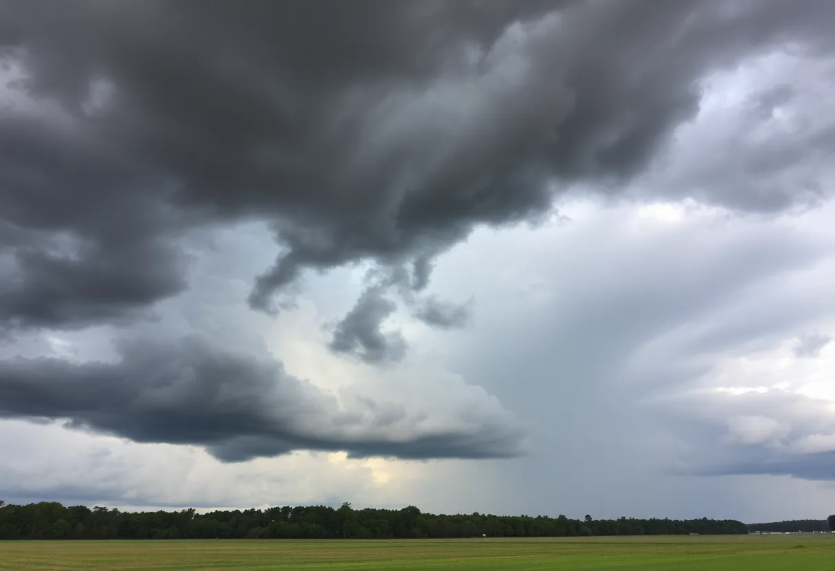
Severe Thunderstorm Warnings Hit the Midlands of South Carolina
Columbia has been put on high alert as the National Weather Service (NWS) has issued a severe thunderstorm warning that residents need to pay attention to. The warning was put into effect on Tuesday at 9:42 p.m. and will stay active until 10 p.m. It covers several counties, including Fairfield, Lexington, and Richland.
What to Expect
People in the affected areas should brace for some wild weather, with wind gusts predicted to reach up to 60 mph. It sounds like a rough ride ahead; the severe thunderstorms are currently racing along a line from Jenkinsville to Harbison State Forest, Oak Grove, and Red Bank, moving east at about 45 mph as of 9:41 p.m. This isn’t just a light sprinkle with a breezy day; the NWS warns that there could be significant damage to trees and power lines.
The cities that are likely to feel the impact of this rough weather include Columbia, Lexington, West Columbia, Cayce, Irmo, Forest Acres, Springdale, Dentsville, Oak Grove, and numerous others. So if you live in or near these areas, it’s wise to be prepared!
Highways Under Watch
If you’re hitting the roads, take extra caution. Major highways under the warning include portions of:
- Interstate 126: mile markers 0 to 3
- Interstate 20: mile markers 48 to 78
- Interstate 26: mile markers 90 to 116
- Interstate 77: mile markers 0 to 2, 5 to 6, and 8 to 37
Hydroplaning could be a genuine concern if the rain gets heavy since vehicles may slide uncontrollably on wet roads due to water buildup. It’s best to stay alert while driving!
Safety First
In light of this impending storm, it’s a great idea to seek safety indoors. The NWS recommends moving to an interior room on the lowest floor of a building. Lightning is another thing to consider, as it strikes the U.S. an astounding 25 million times a year, with about 20 fatalities occurring annually.
More Storms on the Horizon
As if this wasn’t enough, Columbia has had its fair share of weather woes lately. More than 10,000 customers lost power after storms hit on Sunday, with wind gusts and hail causing chaos. Just last week, downed branches and trees resulted in treacherous driving conditions, leading to power outages.
This week remains uncertain, with another round of severe weather expected on Monday. This could lead to strong storms and even tornadoes, particularly between 2 PM and 7 PM. Rainfall could exceed one inch, particularly when thunderstorms roll in.
Plan Ahead
As the week progresses, expect high temperatures around 90°F, resulting in some unusually warm weather for this time of year. A Severe Thunderstorm Watch also remains in effect until 9 p.m. for surrounding counties, including Calhoun, Clarendon, Kershaw, Lee, Orangeburg, and Sumter.
With isolated large hail and flash flooding also posing threats, residents are recommended to keep updated with local conditions. It’s better to be safe than sorry!
So, Columbia! Stay vigilant, take precautions, and prepare yourself for whatever Mother Nature decides to throw your way. Keep safe, and let’s hope for calmer skies soon!
Deeper Dive: News & Info About This Topic
HERE Resources
Strong Thunderstorms and Tornadoes Hit South Carolina and Georgia
Columbia Residents Discuss Williams Street Extension Project
West Columbia Adopts $26.3 Million Budget with Reduced Property Tax
Severe Thunderstorms Roll Into Kentucky: What You Need to Know!
Intense Storms Impact Central South Carolina
Severe Flood Advisory for Calhoun, Lexington, and Orangeburg Counties
Lexington Police Seek Help in Locating Missing Man
Severe Thunderstorm Warnings Sweep Across South Carolina
Flash Flood Warning Hits Lexington and Richland Counties
Twisted Whisk Bakery Expands Services with Walk-In Model
Additional Resources
- Herald Online: Severe Weather Update
- Wikipedia: Severe Convection
- The State: Severe Thunderstorm Watch
- Google Search: Severe Thunderstorm South Carolina
- WLTX: Severe Thunderstorm Threat
- Encyclopedia Britannica: Thunderstorm
- WACH: Columbia SC Weather Alert
- Google News: Columbia Weather Alerts
Author: STAFF HERE LEXINGTON WRITER
The LEXINGTON STAFF WRITER represents the experienced team at HERELexington.com, your go-to source for actionable local news and information in Lexington, Fayette County, and beyond. Specializing in "news you can use," we cover essential topics like product reviews for personal and business needs, local business directories, politics, real estate trends, neighborhood insights, and state news affecting the area—with deep expertise drawn from years of dedicated reporting and strong community input, including local press releases and business updates. We deliver top reporting on high-value events such as Woodland Art Fair, Crave Food and Music Festival, and Railbird Festival. Our coverage extends to key organizations like Commerce Lexington and Blue Grass Community Foundation, plus leading businesses in education, manufacturing, and technology that power the local economy such as University of Kentucky, Toyota Motor Manufacturing, and Lexmark. As part of the broader HERE network, including HEREBowlingGreen.com and HERELouisville.com, we provide comprehensive, credible insights into Kentucky's dynamic landscape.


