News Summary
Residents in South Carolina are facing severe thunderstorm warnings with expectations of up to 60 mph winds and penny-sized hail. The National Weather Service has urged residents in affected counties to take shelter and stay safe from potential lightning strikes and flash flooding. A state of emergency has been declared in nearby Georgia due to severe weather activity. It’s critical for people to remain indoors, heed safety warnings, and remain aware of the damaging risks associated with these storms.
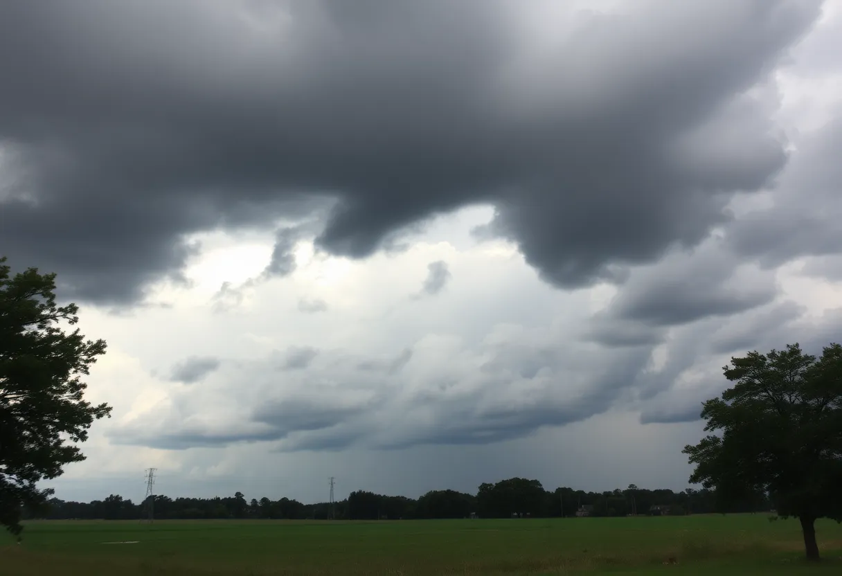
Severe Thunderstorm Warnings Sound Alarm for South Carolina Residents
As the skies darken and storm clouds roll in, folks in South Carolina are bracing themselves for some serious weather. On Wednesday afternoon, the National Weather Service (NWS) Columbia issued a severe thunderstorm warning at 5:04 p.m., which is set to be in effect until 5:30 p.m. This warning covers the counties of Aiken, Calhoun, Lexington, and Orangeburg.
Your Local Forecast: What to Expect
Hold onto your hats, everyone! These storms are no joke. The NWS is predicting wind gusts that could reach up to a staggering 60 mph and hail that might be as big as penny-sized (that’s about 0.75 inches for those keeping track). For those of you in or around Swansea, Wagener, North, Pelion, Salley, Neeses, and surrounding areas, it’s time to take those weather warnings seriously.
A severe thunderstorm was reported to be located just 11 miles southwest of Gaston, which is powering northeast at a comfortable 10 mph. But don’t be fooled by its slow pace; this storm could still pack quite a punch, bringing damage to trees and powerlines along its path.
Safety First: What You Should Do
In light of the stormy weather, it’s crucial to stay safe. The NWS suggests that folks move to an interior room on the lowest floor of your building to avoid those sudden bursts of cloud-to-ground lightning—one of nature’s real showstoppers. Remember, if you can hear thunder, then you are close enough to be at risk of a lightning strike!
But that’s not the only thing to worry about. The heavy rains associated with these storms could lead to flash flooding. So, if you’re driving, heed the warnings: do not attempt to drive through flooded roadways or areas where water pools dangerously. It’s just not worth the risk!
Earlier Thunderstorm Warnings: A Review
Just a couple of hours earlier, at 3:27 p.m., another severe thunderstorm warning was issued for Aiken County, which lasted until 4 p.m. The forecast at that time included wind gusts also reaching up to 60 mph and hail potentially the size of quarters (1 inch), with expected damage to vehicles and trees at stake. Places affected included Aiken, the Aiken Mall, and nearby areas near Interstate 20.
Tornados and Emergency Declarations
As if that weren’t enough, a state of emergency has been declared in Georgia by Governor Brian Kemp due to the severe weather expected across the region. Tornado warnings and watches have also been issued in Augusta, and reports of tornado activity have been indicated in surrounding counties. So, it’s clearly a time to stay alert!
Lightning: A Hidden Danger
For those who might be unaware, lightning is considered one of nature’s leading killers, with approximately 25 million lightning strikes occurring in the United States annually. While these numbers seem staggering, only about 20 fatalities are reported each year. The risk of lightning strikes especially increases as storms approach and peaks when the storms are directly overhead. This should definitely cause you to think twice the next time you hear a rumble of thunder.
Finally, don’t forget about hydroplaning. This phenomenon happens when a vehicle slides out of control on wet roads, thanks to water pooling in front of the tires. It’s something to keep in mind, especially if you find yourself caught in the rainy chaos.
For now, stay safe, stay indoors if you can, and keep an eye out for further weather updates. Happy storm watching, and fingers crossed that the worst passes us by!
Deeper Dive: News & Info About This Topic
HERE Resources
Flash Flood Warning Initiated for Lexington and Saluda Counties
Severe Thunderstorm Watch Issued for Midlands Area
Tropical Storm Chantal Approaches South Carolina Coast
Lake Wind Advisory Issued for South Carolina Counties
Severe Thunderstorm Alerts Sweep Across South Carolina
Water Service Disruptions in Lexington County
Strong Thunderstorms on the Horizon for Orangeburg County
Severe Thunderstorm Warning Hits Columbia, SC
Vintage Cars Converge at the 2025 Great Race Finale
Lexington Police Locate Missing Man Michael Donnelly Safely
Additional Resources
- Island Packet
- Google Search: Weather in South Carolina
- Augusta Chronicle
- Wikipedia: Tornado
- WACH
- Encyclopedia Britannica: Severe Storm
- WJBF
- Google News: Tornado Warning Georgia
- WRDW
- Google Scholar: Lightning Safety
- WISTV
Author: STAFF HERE LEXINGTON WRITER
The LEXINGTON STAFF WRITER represents the experienced team at HERELexington.com, your go-to source for actionable local news and information in Lexington, Fayette County, and beyond. Specializing in "news you can use," we cover essential topics like product reviews for personal and business needs, local business directories, politics, real estate trends, neighborhood insights, and state news affecting the area—with deep expertise drawn from years of dedicated reporting and strong community input, including local press releases and business updates. We deliver top reporting on high-value events such as Woodland Art Fair, Crave Food and Music Festival, and Railbird Festival. Our coverage extends to key organizations like Commerce Lexington and Blue Grass Community Foundation, plus leading businesses in education, manufacturing, and technology that power the local economy such as University of Kentucky, Toyota Motor Manufacturing, and Lexmark. As part of the broader HERE network, including HEREBowlingGreen.com and HERELouisville.com, we provide comprehensive, credible insights into Kentucky's dynamic landscape.


