News Summary
Residents in Sumter and Clarendon Counties are advised to prepare for severe thunderstorms, with warnings indicating wind gusts up to 60 mph and quarter-sized hail. The storms, which are already affecting areas including Manning and Alcolu, pose risks of damaging winds and hail. The National Weather Service recommends seeking shelter and staying informed about weather updates to ensure safety during this hazardous weather event.
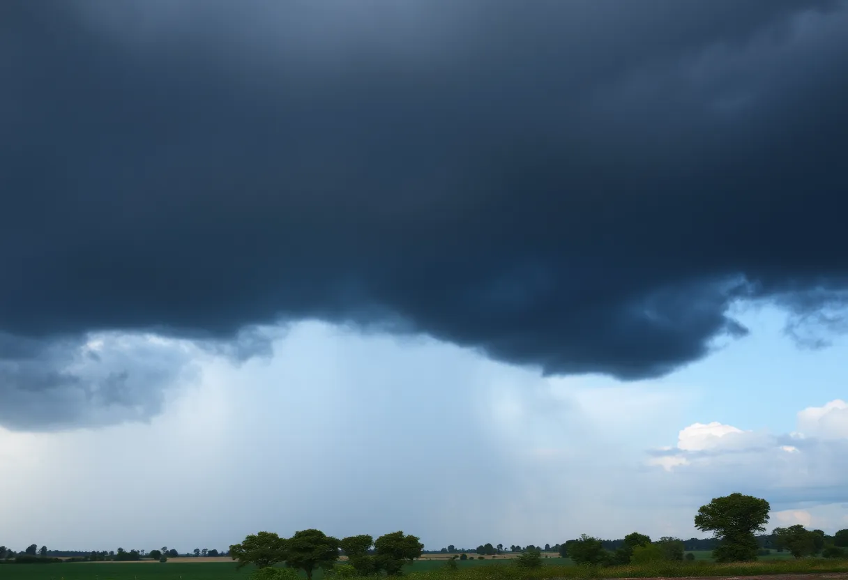
Severe Thunderstorm Warning for Sumter and Clarendon Counties
Residents of Sumter and Clarendon Counties, brace yourselves! A severe thunderstorm warning has been issued by the National Weather Service (NWS) at 4:54 p.m. on Wednesday, and it’s in effect until 5:45 p.m. This storm could pack a punch with powerful winds and some hail!
What to Expect
The forecast indicates that this storm may bring wind gusts of up to 50 mph along with some penny-sized hail—that’s about 0.75 inches. Not to be taken lightly, these gusty winds have the potential to knock down tree limbs and toss around any unsecured outdoor items, leading to minor damage.
Where is the Storm Headed?
Doppler radar has already spotted a robust thunderstorm about 8 miles south of Sumter, and it’s moving southeast at a speed of 25 mph. The areas specifically mentioned in the warning include Manning, Santee Cooper Regional Airport, Alcolu, Pinewood, Paxville, Davis Station, Brogdon, Lakewood, Privateer, and Foreston.
If you’re planning to travel, do note that this also affects portions of Interstate 95 between mile markers 113 and 129.
Continuing Thunderstorm Risks
Not only does this put Manning, Alcolu, Paxville, Brogdon, and Foreston on alert, but it also impacts a segment of Interstate 95 between mile markers 116 and 129.
Safety First!
As this weather rolls in, the NWS is urging residents to take proper safety measures. If you’re outdoors, find shelter inside a sturdy building as quickly as possible. It’s critical to move to a low interior room, preferably on the lowest floor, for the best protection during the storm.
Be sure to keep up with weather updates on your local radio and television stations. Storms such as these can lead to dangerous lightning strikes, which hit the U.S. about 25 million times each year! Unfortunately, they can also lead to about 20 fatalities annually.
Driving Dangers
With storms come the possibility of dangerous driving conditions. Hydroplaning is a real risk when driving on wet roads, which happens when water builds up and causes vehicles to slide out of control. If you’re hitting the roads during stormy weather, keep your distance from other vehicles, slow down, and avoid parking near fast-moving water.
Remember, it’s essential to stay safe during storms, and that means steering clear of flooded roadways and staying informed about weather updates. The beautiful sunshine may be ahead, but for now, let’s be smart and stay out of harm’s way!
Deeper Dive: News & Info About This Topic
HERE Resources
Severe Weather Warnings Issued for the Midwest and Plains
Midlands Business Landscape Faces Significant Changes
Flood Advisory Issued for Aiken and Surrounding Counties
Columbia Residents Prepare for Severe Weather and Police Graduates Celebrate
Severe Weather Threatens Community Summit in Columbia
South Carolina Braces for Rainy Weekend Ahead
Severe Thunderstorm Warning Issued for Aiken and Lexington Counties
Severe Weather Approaches North Carolina: Key Alerts
Strong Thunderstorm Alert in Columbia and Surrounding Areas
South Carolina Faces State of Emergency Due to Severe Flooding
Additional Resources
- The State: Severe Weather Update
- Wikipedia: Severe Thunderstorm Warning
- The State: Latest Weather News
- Google Search: Thunderstorm Safety Tips
- Herald Online: Weather Alerts
- Google Scholar: Thunderstorm Impact
- AlabamaWX: Weather Resources
- Encyclopedia Britannica: Thunderstorms
- AL.com: Severe Thunderstorms in Sumter County
- Google News: Thunderstorm Warnings
Author: STAFF HERE LEXINGTON WRITER
The LEXINGTON STAFF WRITER represents the experienced team at HERELexington.com, your go-to source for actionable local news and information in Lexington, Fayette County, and beyond. Specializing in "news you can use," we cover essential topics like product reviews for personal and business needs, local business directories, politics, real estate trends, neighborhood insights, and state news affecting the area—with deep expertise drawn from years of dedicated reporting and strong community input, including local press releases and business updates. We deliver top reporting on high-value events such as Woodland Art Fair, Crave Food and Music Festival, and Railbird Festival. Our coverage extends to key organizations like Commerce Lexington and Blue Grass Community Foundation, plus leading businesses in education, manufacturing, and technology that power the local economy such as University of Kentucky, Toyota Motor Manufacturing, and Lexmark. As part of the broader HERE network, including HEREBowlingGreen.com and HERELouisville.com, we provide comprehensive, credible insights into Kentucky's dynamic landscape.
