News Summary
South Carolina is bracing for severe thunderstorms and heavy rain this weekend, starting June 5. The National Weather Service has issued warnings for possible strong storms and localized flash flooding, particularly in the Midlands region. Residents are advised to stay alert for updates and avoid flooded roads. Following this stormy weekend, the forecast for next week suggests drier weather and milder temperatures, bringing some relief after recent chaos from severe weather.
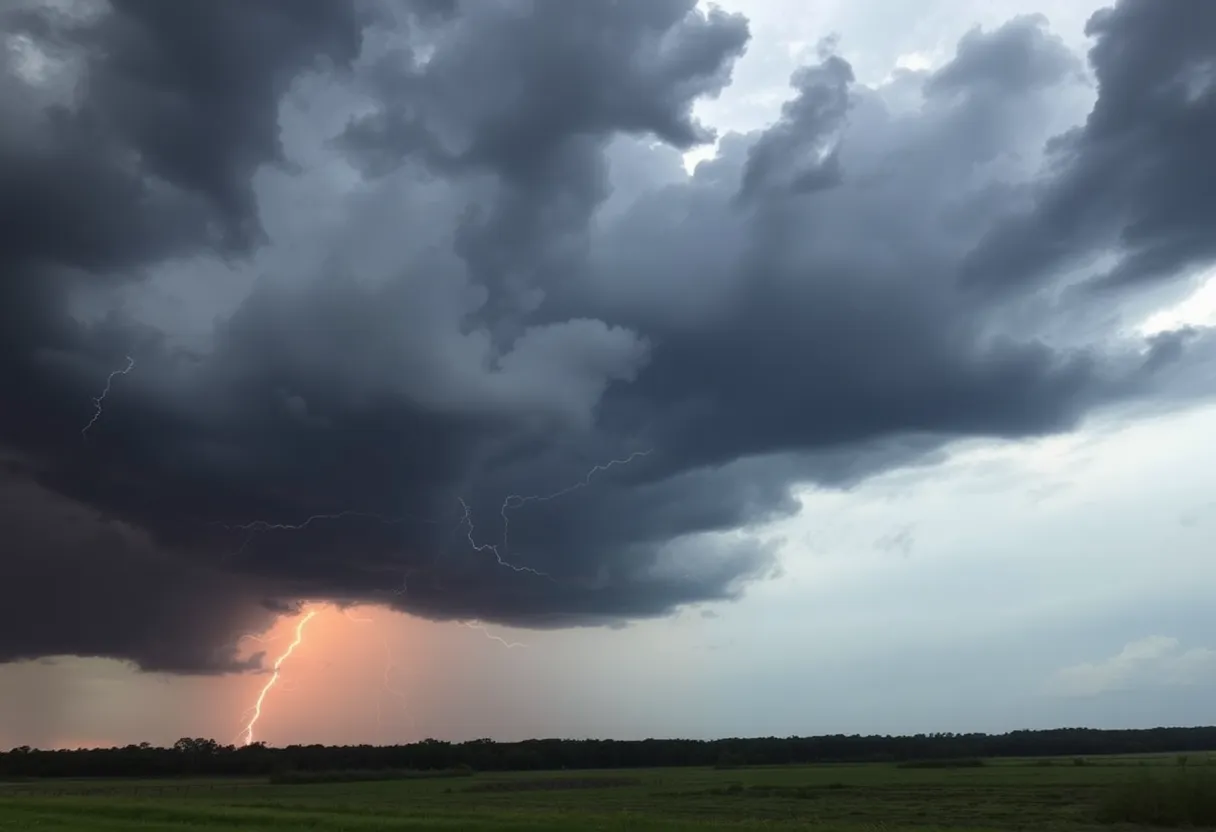
Severe Thunderstorms and Heavy Rain Heading to South Carolina This Weekend!
As residents of South Carolina gear up for the weekend, they should brace themselves for a *wild* weather ride! Starting Thursday, June 5, and running through Sunday, June 8, thunderstorms and heavy rain are expected to sweep across much of the state, bringing with them a mix of excitement and concern.
Weather Watch Alert!
The National Weather Service in Columbia has warned about a pesky slow-moving *wet pattern* that could result in multiple rounds of rain and the potential for isolated strong thunderstorms. Specific regions, like the Midlands—which includes places like Columbia, Lexington, and Orangeburg—are currently under a Slight Risk (2 out of 5) for severe storms this Saturday and Sunday.
Residents are encouraged to prepare for the possibility of *brief damaging wind gusts*, localized flash flooding, and frequent lightning, especially during the afternoons and evenings. Motorists planning to travel on major highways like I-20 and I-26 may face challenges due to reduced visibility and areas of pooling water on the roads, making for a *slippery and hazardous* journey.
Pop-Up Storms Ahead!
The ever-changing summer heat is likely to fuel some daily surprise storms, leaving outdoor plans in a bit of a *weather limbo*. Saturday and Sunday afternoons could see the strongest storms develop rapidly, so it’s wise to keep an eye on the forecast as the weekend approaches.
Safety Comes First!
As a precaution, emergency managers are advising everyone in South Carolina to stay alert for weather updates, charge up their mobile devices, and especially avoid flooded roads as conditions could worsen. Rain chances will be high through Sunday night, and if things take a turn for the worse, additional weather watches may be put into effect.
As of late Friday afternoon, a severe thunderstorm watch has been issued for several counties including Bamberg, Barnwell, Calhoun, Clarendon, Lee, Orangeburg, and Sumter, lasting until 8 p.m. Residents should stay well-informed, as thunderstorms can lead to significant weather-related risks.
What You Need to Know About Thunderstorms
It’s interesting to note that lightning strikes the U.S. around 25 million times annually, and a good chunk of these strikes occur during the summer months, unfortunately leading to around 20 fatalities each year. When thunder starts rumbling, experts recommend seeking *indoor shelter* and being conscious of the dangers of hydroplaning while driving.
In case you are unaware, hydroplaning happens when too much water in front of your tires builds up too quickly, causing your vehicle to lose control. It’s a *scary situation*, so staying aware and cautious is key!
Recent Weather Impact in the Midlands
Earlier severe weather caused some chaos in the Midlands, resulting in reported downed trees and power lines across different areas. While tornado warnings were issued for Calhoun, Orangeburg, and Clarendon Counties, no confirmed touchdowns had occurred at that time, which is certainly a relief.
Peak power outages saw numbers soar to nearly 9,000 in Lexington County alone, with over 5,600 outages reported combined in Calhoun and Clarendon Counties. It’s been a *bumpy* few days, but as the storms pass, normalcy is just around the corner.
What Lies Ahead!
Looking forward to next week, the forecast seems promising with expectations of drier, calmer weather and temperatures in the low 80s. Nights are projected to be pleasantly cool, ranging from the upper 50s to low 60s. With slightly warmer-than-average temps and low rain chances, South Carolinians could have some well-deserved peace after this stormy weekend.
So, whether you’re planning to *stay in* and watch movies or brave the storm, remember to keep safety at the forefront as South Carolina weathers another weekend of unpredictable storms. Stay safe, stay dry, and cherish those sunny days to come!
Deeper Dive: News & Info About This Topic
HERE Resources
Chapin Community Gathers to Honor Cherished Members
Winter Weather Advisory Issued for Columbia, South Carolina
Wildfires Rage Across North and South Carolina
South Carolina Battles Widespread Wildfires Amid Emergency
Launch of Spectrum News South Carolina Enhances Local Coverage
Former Sheriff’s Department Employee Arrested for Fraud
Columbia, S.C. Weather Forecast Indicates Changes Ahead
Severe Thunderstorms Ready to Soak Columbia, SC This Afternoon
South Carolina Faces Disappointing First Snowfall of 2024
Blind Boys of Alabama to Perform at Koger Center
Additional Resources
- WLTX News
- Wikipedia: Severe Thunderstorm
- The State
- Google Search: Severe Storms South Carolina
- Herald Online
- Google Scholar: Severe Storms
- WACH Weather Blog
- Encyclopedia Britannica: Thunderstorm
- The State
- Google News: Thunderstorms in South Carolina
Author: STAFF HERE LEXINGTON WRITER
The LEXINGTON STAFF WRITER represents the experienced team at HERELexington.com, your go-to source for actionable local news and information in Lexington, Fayette County, and beyond. Specializing in "news you can use," we cover essential topics like product reviews for personal and business needs, local business directories, politics, real estate trends, neighborhood insights, and state news affecting the area—with deep expertise drawn from years of dedicated reporting and strong community input, including local press releases and business updates. We deliver top reporting on high-value events such as Woodland Art Fair, Crave Food and Music Festival, and Railbird Festival. Our coverage extends to key organizations like Commerce Lexington and Blue Grass Community Foundation, plus leading businesses in education, manufacturing, and technology that power the local economy such as University of Kentucky, Toyota Motor Manufacturing, and Lexmark. As part of the broader HERE network, including HEREBowlingGreen.com and HERELouisville.com, we provide comprehensive, credible insights into Kentucky's dynamic landscape.


